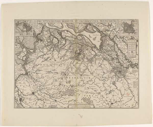
Kaart van Limburg met de omgeving rond Maastricht, 1708 1708 - 1712
jacobusharrewijn
Rijksmuseum
drawing, print, engraving
drawing
pen sketch
old engraving style
landscape
line
engraving
Dimensions: height 436 mm, width 570 mm
Copyright: Rijks Museum: Open Domain
Editor: Here we have Jacobus Harrewijn’s "Kaart van Limburg met de omgeving rond Maastricht, 1708", created between 1708 and 1712. It’s an engraving that gives us a meticulously detailed map of the Limburg region. It’s striking how this print combines artistry with functionality. What sociopolitical factors do you feel influenced this particular representation of space? Curator: This map, beyond its geographical accuracy, is a powerful assertion of territorial control. Notice how the landscape isn't just represented, but *performed* through meticulous detail, signaling possession and knowledge. Consider, too, that cartography at this time was a deeply political act; who gets to define and delineate borders? Who is included and excluded in these representations? The level of detail suggests a clear message aimed at asserting power. Who do you think the intended audience may have been for this type of map, and how might their identity shape their interpretation of it? Editor: Given its detail, perhaps military leaders or administrators needing precise knowledge of the region? How would those individuals have responded versus the farmers or the local populace depicted *within* the landscape? Curator: Exactly! The local populace might perceive this not as a neutral depiction, but as a tool of governance. Their lands and lives are being surveyed and codified, potentially foreshadowing taxation or military mobilization. It underscores the idea that maps aren't just objective renderings, but reflect the ideology of their creators. The very act of creating this map is an act of power. How does knowing the history affect your interpretation of this artwork? Editor: It certainly moves beyond just appreciating the artistic technique and allows to think about this work within an historical perspective, how maps such as this also play a key role in constructing socio-political realities. I’ll never see a map the same way! Curator: Precisely, that is why understanding that the map also reflects the intersectional power dynamics and broader historical narratives offers the means of understanding of visual culture.
Comments
No comments
Be the first to comment and join the conversation on the ultimate creative platform.