drawing, print, ink, engraving
#
drawing
#
dutch-golden-age
# print
#
landscape
#
ink
#
geometric
#
engraving
Dimensions: height 400 mm, width 559 mm
Copyright: Rijks Museum: Open Domain
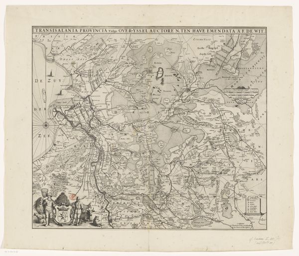
This is an anonymous map of the north-western part of Brabant. Look closely, and you'll see the land depicted as a network of signs—each village, river, and forest a symbol of human presence and nature's influence. Notice the walled cities, like strongholds of civilization, juxtaposed against the wild, untamed forests. This contrast echoes throughout history, reappearing in countless artworks and mythologies. Think of the 'city upon a hill' versus the 'dark forest' of fairy tales, symbols ingrained in our collective unconscious, representing safety versus the unknown. The forests, too, are not merely trees. In older Germanic traditions, groves were sacred places, embodying both refuge and peril. This duality—shelter and threat—still resonates today, reminding us of our complex relationship with the natural world. This map is more than lines on paper; it's a tapestry woven with ancient symbols and cultural memory, revealing how we perceive and interact with our world. It is a reminder of the cyclical nature of symbols, constantly resurfacing and evolving through time.
Comments
No comments
Be the first to comment and join the conversation on the ultimate creative platform.
More like this