print, etching
#
dutch-golden-age
# print
#
etching
#
landscape
#
etching
Dimensions: height 397 mm, width 503 mm
Copyright: Rijks Museum: Open Domain
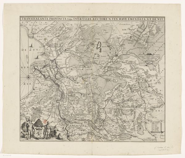
This anonymous map of Overijssel meticulously rendered, is a silent tapestry woven with symbols of power and orientation. Dominating the map's corners are ornate cartouches, frames for text. These decorative elements aren't mere embellishments; they're echoes of triumphal arches, symbols of Roman imperial power, here subtly adapted to assert authority over this Dutch province. The compass rose, too, is more than a navigational tool; it's a microcosm of the world, a symbolic ordering of the chaos of the unknown. We see similar symbols of direction and knowledge in much earlier world maps, the medieval "mappa mundi," yet each age infuses these symbols with new layers of meaning, reflecting shifting worldviews. The psychological comfort in orientation cannot be overstated. Humans impose structure, seeking control over their environment. Like the recurring motifs in dreams, these symbols persist, reborn in each new era, whispering forgotten stories to those who know how to listen.
Comments
No comments
Be the first to comment and join the conversation on the ultimate creative platform.
More like this