#
rippled sketch texture
#
linocut
#
ink paper printed
#
old engraving style
#
woodcut effect
#
etching
#
linocut print
#
ink drawing experimentation
#
pen-ink sketch
#
pen work
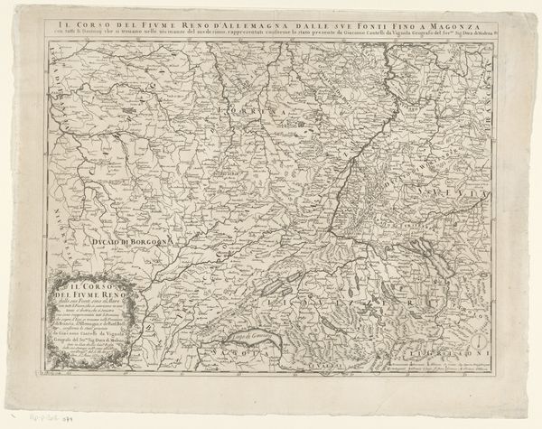
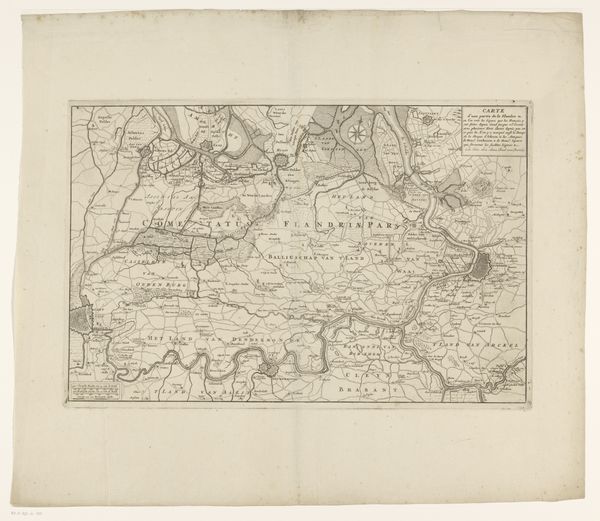
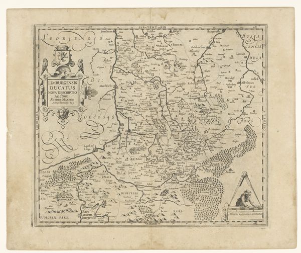
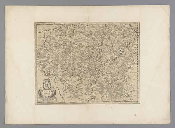
Dimensions: height 421 mm, width 514 mm
Copyright: Rijks Museum: Open Domain
Curator: Look at this remarkable map from 1703, titled "Kaart van het noordelijke deel van het prinsbisdom Luik," housed here at the Rijksmuseum. It is unsigned, authorship remains anonymous. Editor: The intricacy is mesmerizing. The texture achieved through etching or a similar method gives the whole piece an atmospheric, almost ethereal quality. It really draws the eye in despite the somewhat muted palette. Curator: It speaks volumes about early 18th-century modes of production, doesn’t it? The labour involved in the meticulous rendering of this political landscape. The distribution of the maps also speaks to economic and power structures, revealing who had access to geographic knowledge and therefore strategic advantage. Editor: Indeed. Notice how the cartographer meticulously represents spatial relationships between topological features, emphasizing the formal structures that defined the area? Even without knowledge of the area represented, the viewer can clearly see the structural importance of its various waterways. Curator: The lines also delineate administrative districts, marking areas controlled by particular factions or industries. And what’s implied but not always clear in these renderings, is how deeply material exploitation is embedded within them—the very land being depicted, of course, is a resource. Editor: I’m drawn to how the various lines and marks coalesce into definable and legible regions. The density of the lines gives areas differing degrees of prominence. Even the framing ornamentation acts as an important structural element by bringing further compositional balance to the whole piece. Curator: Right, because the means of distribution themselves reveal social contexts, don’t they? Each printed copy made these geographical data portable, manipulable, and tradable across geographical boundaries; in essence, the paper medium turns spatial information into capital. Editor: Absolutely, and considering the time period, it’s remarkable to observe how sophisticated the graphic design is, especially in establishing visual hierarchy. Even without the historical context you bring to it, this print succeeds as a composition. Curator: Yes, its aesthetic achievement, of course, reflects broader modes of labor, circulation, and consumption occurring at this time. Editor: I agree completely. Bringing a critical understanding of how the formal design allows viewers to extract layers of meaning helps ground material concerns within historical parameters.
Comments
No comments
Be the first to comment and join the conversation on the ultimate creative platform.
More like this