About this artwork
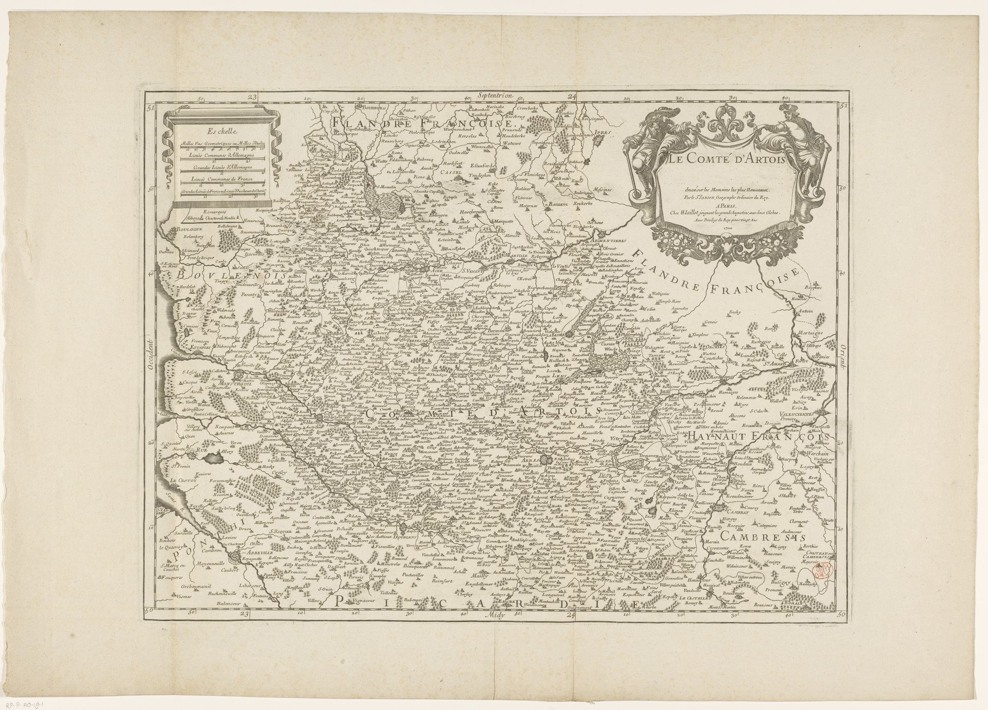
This detailed map of the County of Artois, now in the Rijksmuseum, was created anonymously during a period of shifting territorial claims and conflicts. Maps are never neutral; they represent a worldview. This one offers a fascinating insight into the identities and power dynamics of the time. Artois, situated on the border between France and the Netherlands, was a region of strategic importance, often caught in the crossfire of European powers. This map, with its careful delineation of towns and natural features, reflects an effort to define and control the region. But who was the map for? Was it a tool for governance, military planning, or perhaps a symbol of regional identity? How did the inhabitants of Artois, with their own diverse backgrounds and loyalties, experience these imposed boundaries? Consider how the map flattens the lived experiences of individuals and communities into lines and symbols, underscoring the power of cartography to shape our understanding of place and belonging.
Artwork details
- Medium
- graphic-art, print, engraving
- Dimensions
- height 429 mm, width 570 mm
- Location
- Rijksmuseum
- Copyright
- Rijks Museum: Open Domain
Tags
graphic-art
baroque
pen sketch
old engraving style
landscape
geometric
engraving
Comments
Be the first to share your thoughts about this work.
About this artwork
This detailed map of the County of Artois, now in the Rijksmuseum, was created anonymously during a period of shifting territorial claims and conflicts. Maps are never neutral; they represent a worldview. This one offers a fascinating insight into the identities and power dynamics of the time. Artois, situated on the border between France and the Netherlands, was a region of strategic importance, often caught in the crossfire of European powers. This map, with its careful delineation of towns and natural features, reflects an effort to define and control the region. But who was the map for? Was it a tool for governance, military planning, or perhaps a symbol of regional identity? How did the inhabitants of Artois, with their own diverse backgrounds and loyalties, experience these imposed boundaries? Consider how the map flattens the lived experiences of individuals and communities into lines and symbols, underscoring the power of cartography to shape our understanding of place and belonging.
Comments
Be the first to share your thoughts about this work.