print, engraving
#
baroque
# print
#
geometric
#
history-painting
#
engraving
Dimensions: height 233 mm, width 303 mm
Copyright: Rijks Museum: Open Domain
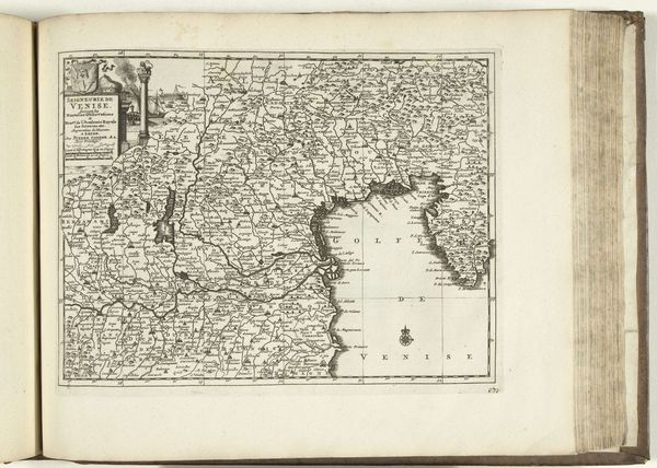
This is an anonymous map of Germany, made in 1726. In the early 18th century, Germany was not yet a unified nation but a patchwork of smaller states, each with its own ruler and identity. This map offers more than just geographical data; it provides a snapshot of a complex political and social landscape. Consider how the act of mapping itself involves decisions about what to include and what to omit, thereby shaping a particular vision of the territory. What does it mean to try to define a place that is not yet a nation? Maps like this one played a role in shaping ideas about national identity and territory. While seemingly objective, such maps are imbued with the cultural perspectives and political agendas of their creators. This particular map invites us to reflect on the relationship between power, knowledge, and representation.
Comments
No comments
Be the first to comment and join the conversation on the ultimate creative platform.
More like this