drawing, print, engraving
#
drawing
#
aged paper
#
baroque
#
ink paper printed
# print
#
pen sketch
#
old engraving style
#
personal sketchbook
#
ink drawing experimentation
#
pen-ink sketch
#
pen work
#
sketchbook drawing
#
sketchbook art
#
engraving
Dimensions: height 345 mm, width 525 mm
Copyright: Rijks Museum: Open Domain
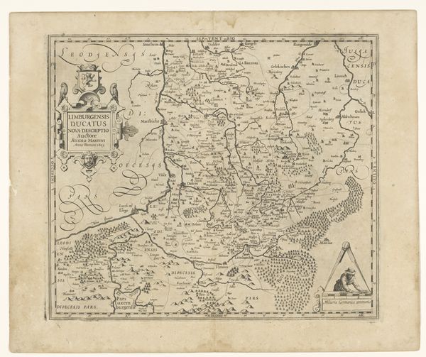
Curator: Here we have "Kaart van Oost-Vlaanderen," which translates to "Map of East Flanders." It's an engraving, dating from 1703 to 1717, created by an anonymous artist, and it is currently held in the collection of the Rijksmuseum. Editor: The map is like a delicate lace, wouldn’t you say? All those fine lines crisscrossing each other. It feels simultaneously precise and romantic… like a secret whispered from one town to the next. Curator: Absolutely, the Baroque era, with its love of ornamentation, really shines through here. Maps, back then, were never just about geography. They were often embedded with symbols representing power, commerce, even the hopes of the people living there. Editor: So, like visual poems filled with encoded meanings? Is the swirling flourish around that compass rose purely decorative, or does it tell us something about their view of the world, about trade winds or who knows what else? It almost feels… alive. Curator: I would say that there’s more to it. Think of the function of maps like this as strategic tools. Flanders was a very desirable and oft conquered location; thus the detailed topography isn't merely documentary, it speaks of careful observation for political-military projection. That explains why they made so many iterations of this artwork. The region held powerful symbolic status. Editor: That makes total sense. So the artist is charting not just land, but also intention. You almost can feel the pulse of ambition beneath the lines of those towns and waterways. Knowing the map's practical significance infuses it with all sorts of narratives—military, certainly, but maybe also tales of travelers and traders, the stories that naturally accumulate where people and places connect. Curator: Precisely. It also reminds us of the layers inherent in any representation. While seemingly objective, maps carry an inherent bias—the cartographer's, the patron's, the culture's. Every element of its composition bears meaning worth deciphering, even if, or especially if, these are implicit to modern eyes. Editor: It makes you want to grab a magnifying glass and set off on an adventure of your own… into history and cartography all at once. Thanks for pointing the way. Curator: My pleasure! The symbolism embedded here keeps the conversation endlessly engaging.
Comments
No comments
Be the first to comment and join the conversation on the ultimate creative platform.
More like this