About this artwork
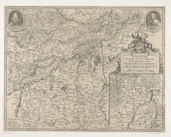
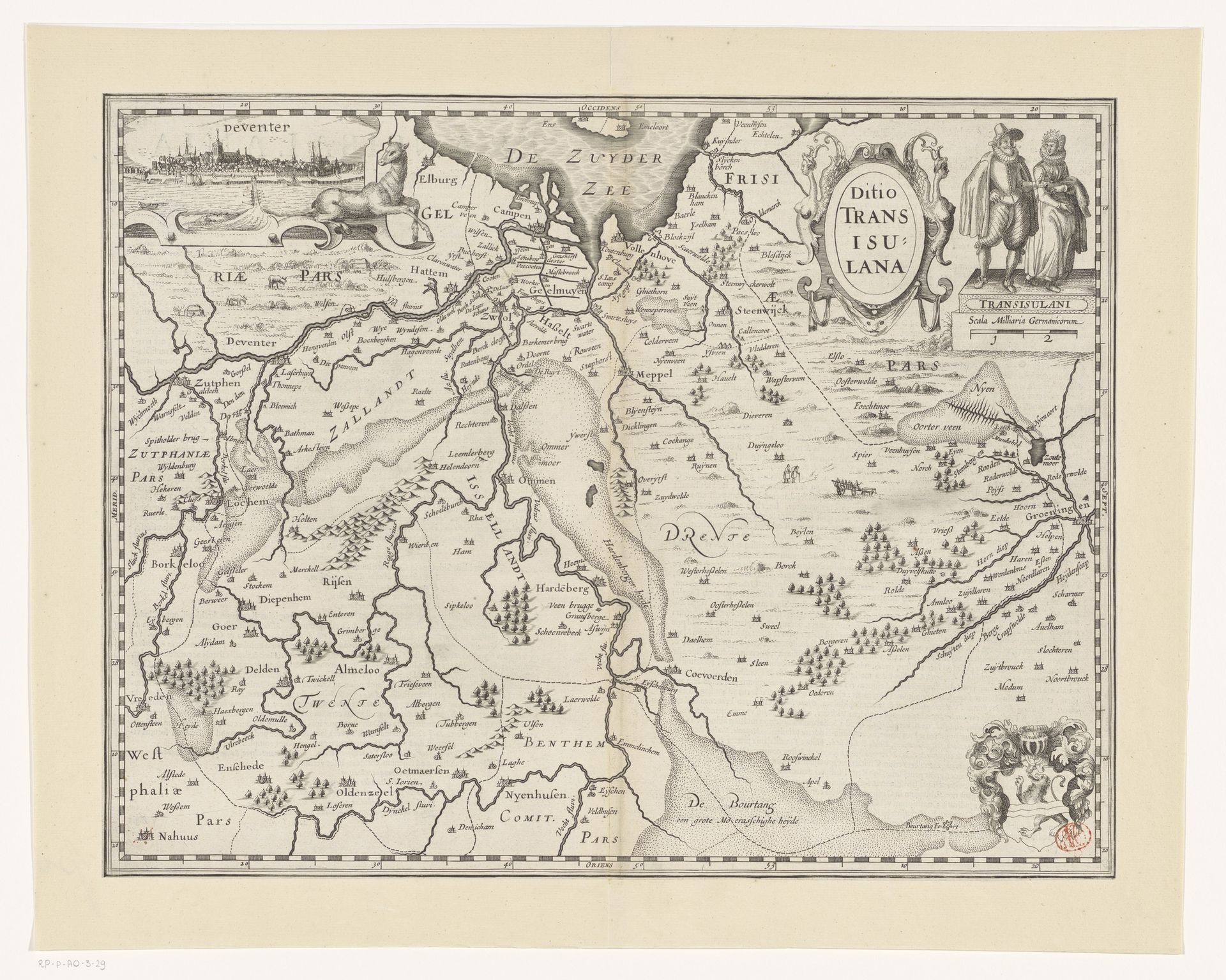
Pieter van der Keere made this map of Overijssel as an engraving sometime between his birth in 1571 and death in 1646. Maps like these offer us a window into the institutional and cultural history of the early modern Netherlands. Notice how the visual codes aren't just geographical. At the top, you'll see figures dressed in what were then fashionable clothes. This is not just a neutral depiction of space; it's a statement about the province's place in the world, its trade routes, and the aspirations of its inhabitants. It also reflects the rise of cartography as a science and a tool of governance. As historians, we can dig into the archives, the economic records, and the personal accounts of the time to understand how this map functioned within its society. It prompts us to ask: who was this map for? What did it mean to them? The meaning of this map emerges from its social and institutional context.
Artwork details
- Medium
- graphic-art, print, engraving
- Dimensions
- height 372 mm, width 483 mm
- Location
- Rijksmuseum
- Copyright
- Rijks Museum: Open Domain
Tags
graphic-art
dutch-golden-age
old engraving style
cityscape
engraving
Comments
No comments
About this artwork
Pieter van der Keere made this map of Overijssel as an engraving sometime between his birth in 1571 and death in 1646. Maps like these offer us a window into the institutional and cultural history of the early modern Netherlands. Notice how the visual codes aren't just geographical. At the top, you'll see figures dressed in what were then fashionable clothes. This is not just a neutral depiction of space; it's a statement about the province's place in the world, its trade routes, and the aspirations of its inhabitants. It also reflects the rise of cartography as a science and a tool of governance. As historians, we can dig into the archives, the economic records, and the personal accounts of the time to understand how this map functioned within its society. It prompts us to ask: who was this map for? What did it mean to them? The meaning of this map emerges from its social and institutional context.
Comments
No comments