About this artwork
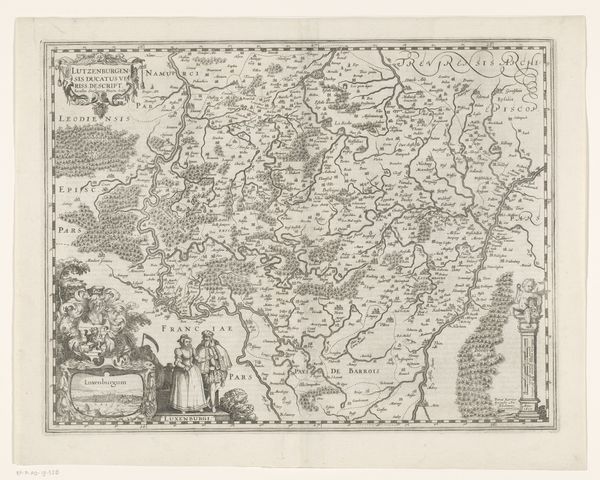
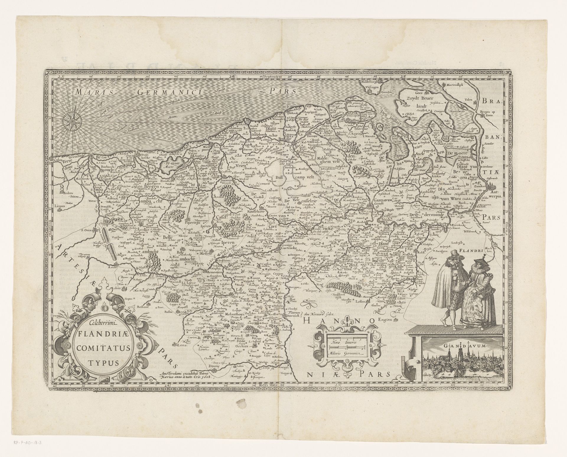
Editor: We're looking at a piece titled "Kaart van het graafschap Vlaanderen, met een gezicht op Gent," a map of the County of Flanders with a view of Ghent. It was created between 1617 and 1622 by an anonymous artist and the medium is engraving. It's incredibly detailed, almost overwhelmingly so at first glance. What structural elements stand out to you in this composition? Curator: Indeed, the sheer density of visual information demands close scrutiny. Observe how the composition is rigidly structured. The prominent, framed map is dominant, while subsidiary imagery – figures and city view – occupy distinctly separate registers. Notice also the strategic placement of cartouches. Consider how such compositional devices contribute to the artwork’s semiotic function as both descriptive geography and emblem of political authority. Editor: Political authority? Curator: Absolutely. Note how the sharp, clean lines of the engraving lend an air of precision and control, reinforcing a sense of dominion over the depicted territory. Consider how the Baroque style informs not just aesthetic choices but also communicates power dynamics through form itself. Is that not telling? Editor: It is! I see now how the strict organization reflects a desire to impose order, both literally on the landscape and symbolically through artistic representation. Curator: Precisely. By deconstructing its visual components, we can understand this map as more than just geographical data; it’s a powerful statement about control and knowledge. Editor: That's fascinating. I initially saw it as just a historical document, but looking at its structure reveals so much more about its purpose. Thank you for that perspective. Curator: It is through such formal dissections that the essence of any artistic endeavor can be accessed, would you not agree?
Kaart van het graafschap Vlaanderen, met een gezicht op Gent 1617 - 1622
Anonymous
@anonymousLocation
RijksmuseumArtwork details
- Medium
- graphic-art, print, engraving
- Dimensions
- height 334 mm, width 481 mm
- Location
- Rijksmuseum
- Copyright
- Rijks Museum: Open Domain
Tags
graphic-art
baroque
old engraving style
landscape
cityscape
engraving
Comments
No comments
About this artwork
Editor: We're looking at a piece titled "Kaart van het graafschap Vlaanderen, met een gezicht op Gent," a map of the County of Flanders with a view of Ghent. It was created between 1617 and 1622 by an anonymous artist and the medium is engraving. It's incredibly detailed, almost overwhelmingly so at first glance. What structural elements stand out to you in this composition? Curator: Indeed, the sheer density of visual information demands close scrutiny. Observe how the composition is rigidly structured. The prominent, framed map is dominant, while subsidiary imagery – figures and city view – occupy distinctly separate registers. Notice also the strategic placement of cartouches. Consider how such compositional devices contribute to the artwork’s semiotic function as both descriptive geography and emblem of political authority. Editor: Political authority? Curator: Absolutely. Note how the sharp, clean lines of the engraving lend an air of precision and control, reinforcing a sense of dominion over the depicted territory. Consider how the Baroque style informs not just aesthetic choices but also communicates power dynamics through form itself. Is that not telling? Editor: It is! I see now how the strict organization reflects a desire to impose order, both literally on the landscape and symbolically through artistic representation. Curator: Precisely. By deconstructing its visual components, we can understand this map as more than just geographical data; it’s a powerful statement about control and knowledge. Editor: That's fascinating. I initially saw it as just a historical document, but looking at its structure reveals so much more about its purpose. Thank you for that perspective. Curator: It is through such formal dissections that the essence of any artistic endeavor can be accessed, would you not agree?
Comments
No comments