About this artwork
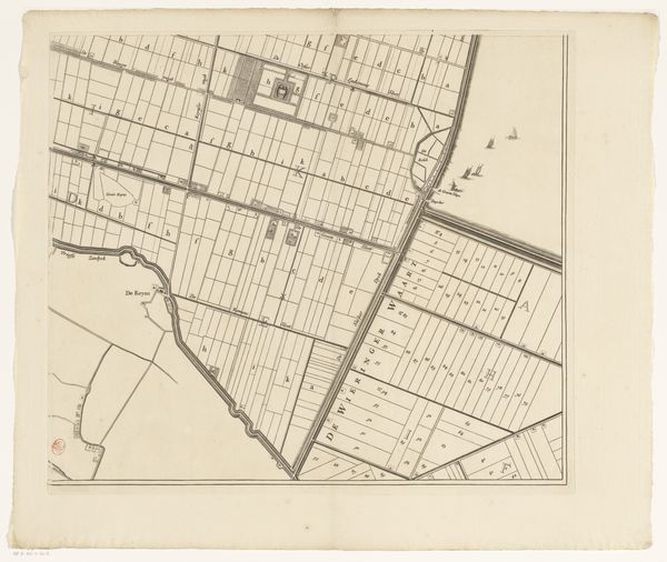
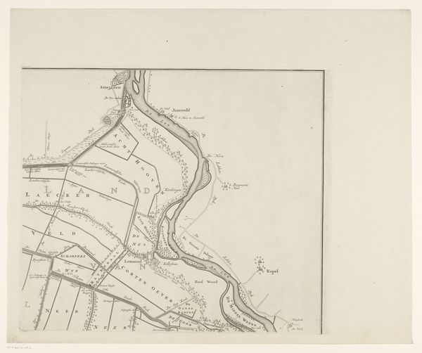
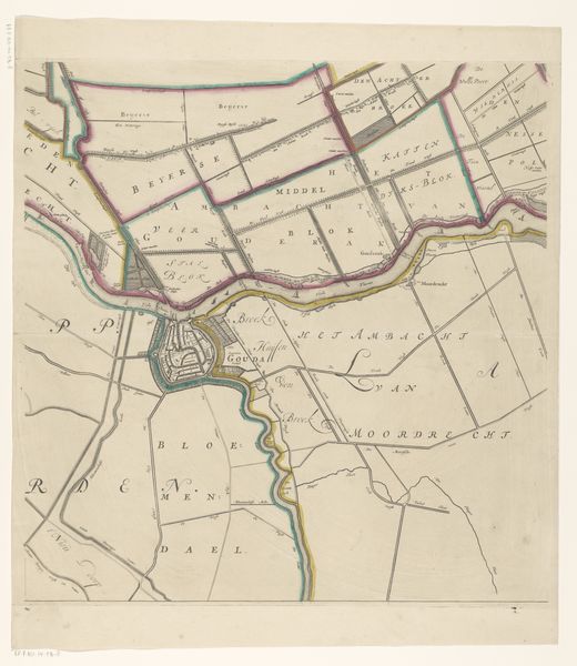
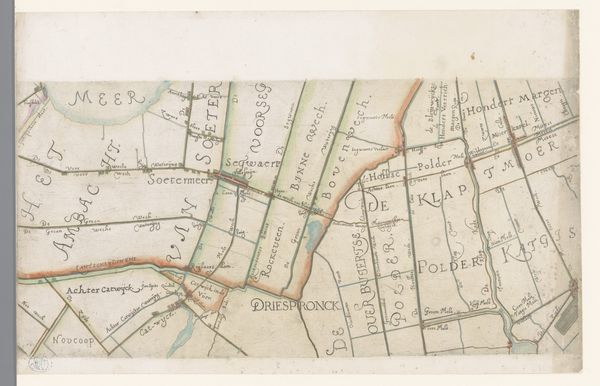
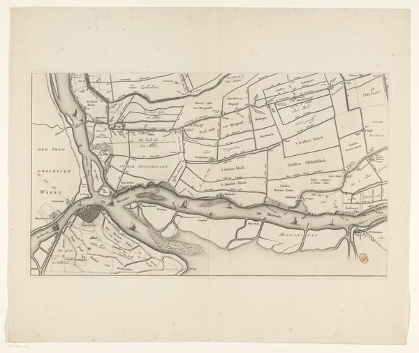
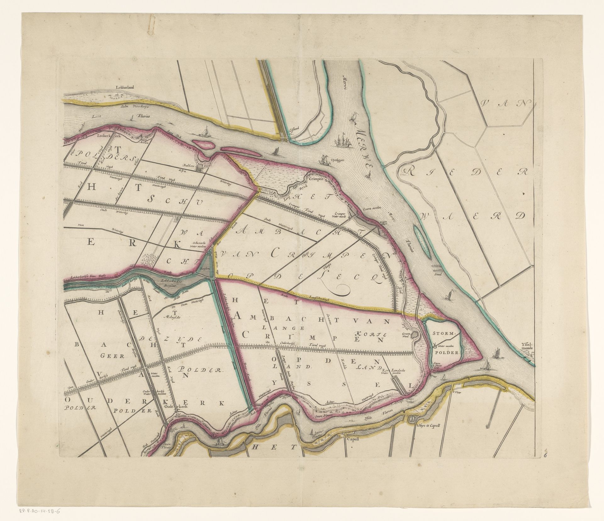
This is a section of Johannes Leupenius’s map of Krimpenerwaard, dating to around 1680, made using ink and watercolor on paper. This wasn’t just a fine art object; it was a functional document, critical to the economic organization of the region. Note the clear delineation of polders - areas of reclaimed land, surrounded by dikes. This wasn't just about geography; it was about control, ownership, and above all, labor. The dikes themselves represent a massive investment of effort. The map itself makes this labor visible, charting the landscape of human intervention. Look closely and you'll see the texture of the paper, the even lines of the drawing, the subtle washes of color. The map bridges the gap between art and utility, reminding us that even seemingly objective documents are crafted objects, shaped by human hands, and reflecting a particular worldview.
Kaart van het Hoogheemraadschap van de Krimpenerwaard (derde deel van kaart) 1683
Johannes Leupenius
1643 - 1693Location
RijksmuseumArtwork details
- Medium
- print, etching
- Dimensions
- height 432 mm, width 522 mm
- Location
- Rijksmuseum
- Copyright
- Rijks Museum: Open Domain
Tags
dutch-golden-age
etching
landscape
etching
Comments
No comments
About this artwork
This is a section of Johannes Leupenius’s map of Krimpenerwaard, dating to around 1680, made using ink and watercolor on paper. This wasn’t just a fine art object; it was a functional document, critical to the economic organization of the region. Note the clear delineation of polders - areas of reclaimed land, surrounded by dikes. This wasn't just about geography; it was about control, ownership, and above all, labor. The dikes themselves represent a massive investment of effort. The map itself makes this labor visible, charting the landscape of human intervention. Look closely and you'll see the texture of the paper, the even lines of the drawing, the subtle washes of color. The map bridges the gap between art and utility, reminding us that even seemingly objective documents are crafted objects, shaped by human hands, and reflecting a particular worldview.
Comments
No comments