About this artwork
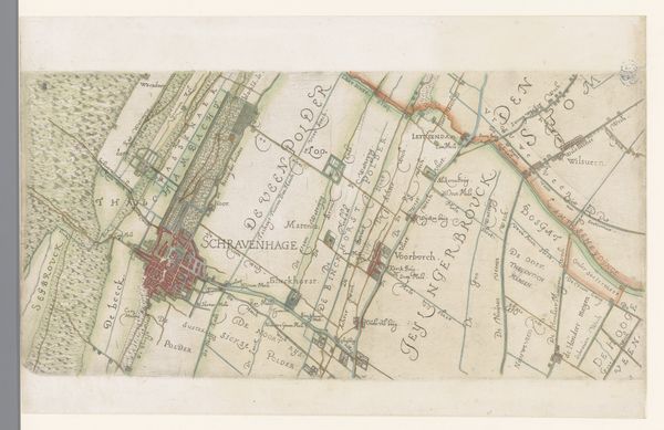
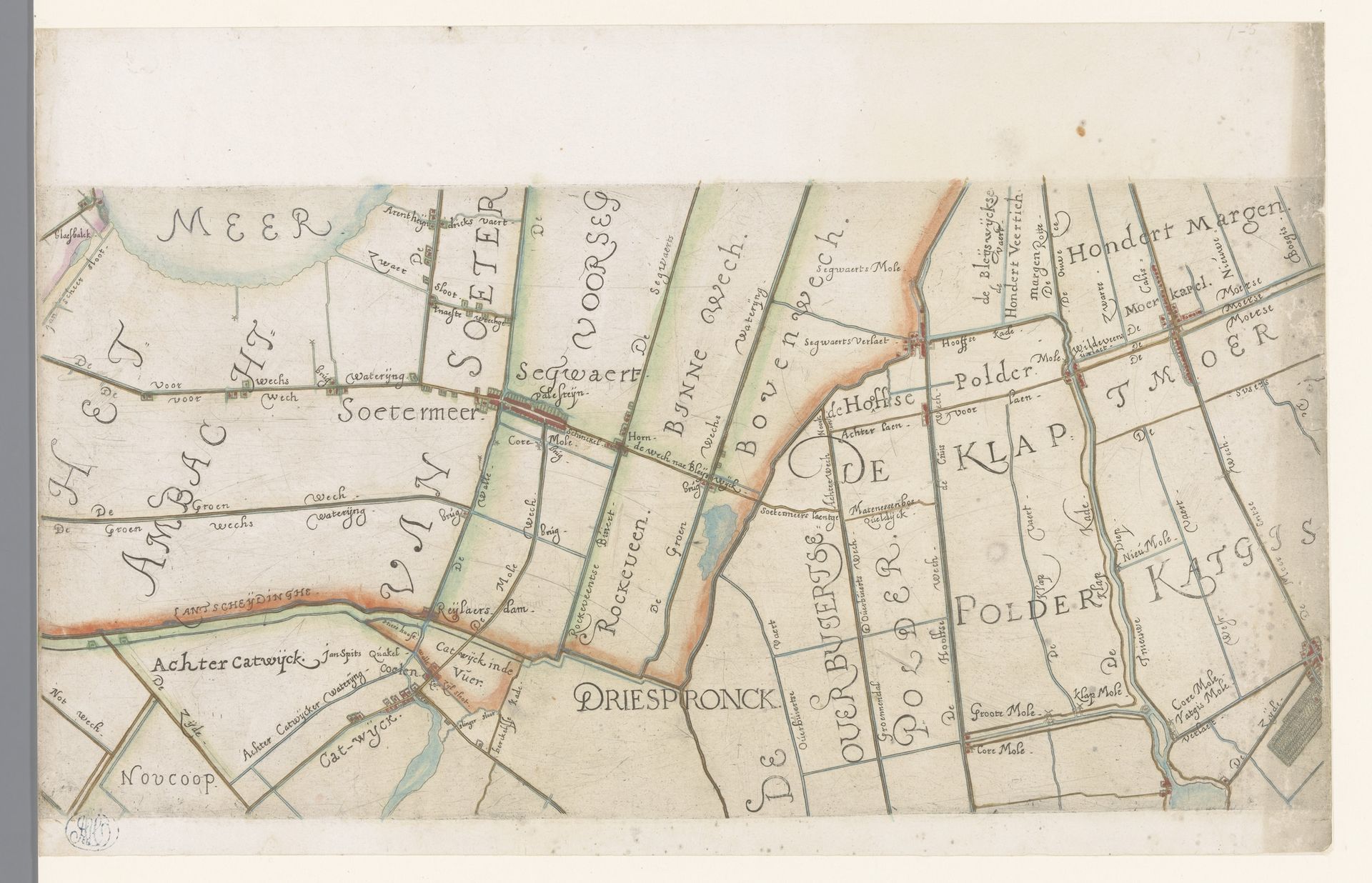
This is a section of a map of Rijnland by Floris Balthasarsz van Berckenrode, made in the late 16th or early 17th century. In it, symbols emerge not as static markers, but as active participants in a cultural memory. Note the presence of water, meticulously charted through canals and waterways. Water is life, but also a force of chaos, constantly threatening to reclaim the structured land. This duality echoes in ancient flood myths, where water both destroys and regenerates. The act of mapping itself becomes a symbolic assertion of control. Across cultures, maps are far more than simple navigational tools. They are a projection of power, a visual declaration of ownership, and a testament to mankind’s relentless drive to order the natural world. We see this same impulse mirrored across time. These symbols have resurfaced, evolved, and taken on new meanings.
Deel van een kaart van het Hoogheemraadschap van Rijnland, met Zoetermeer en omgeving 1615
Floris Balthasarsz van Berckenrode
1562 - 1616Location
RijksmuseumArtwork details
- Medium
- drawing, print, paper
- Dimensions
- height 198 mm, width 401 mm
- Location
- Rijksmuseum
- Copyright
- Rijks Museum: Open Domain
Tags
drawing
dutch-golden-age
landscape
paper
Comments
No comments
About this artwork
This is a section of a map of Rijnland by Floris Balthasarsz van Berckenrode, made in the late 16th or early 17th century. In it, symbols emerge not as static markers, but as active participants in a cultural memory. Note the presence of water, meticulously charted through canals and waterways. Water is life, but also a force of chaos, constantly threatening to reclaim the structured land. This duality echoes in ancient flood myths, where water both destroys and regenerates. The act of mapping itself becomes a symbolic assertion of control. Across cultures, maps are far more than simple navigational tools. They are a projection of power, a visual declaration of ownership, and a testament to mankind’s relentless drive to order the natural world. We see this same impulse mirrored across time. These symbols have resurfaced, evolved, and taken on new meanings.
Comments
No comments