About this artwork
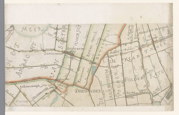
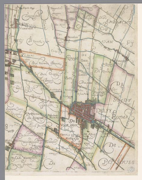
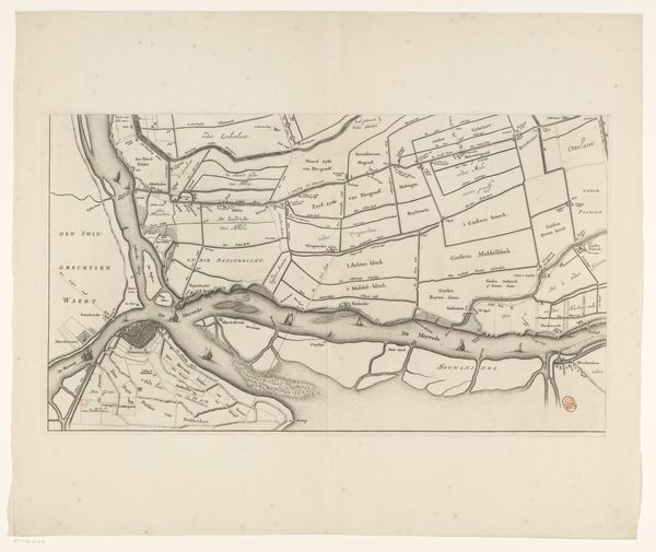
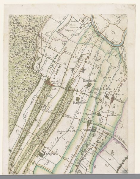
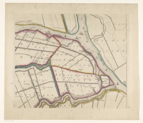
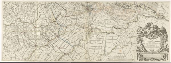
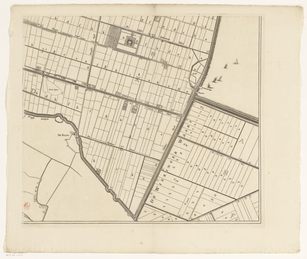
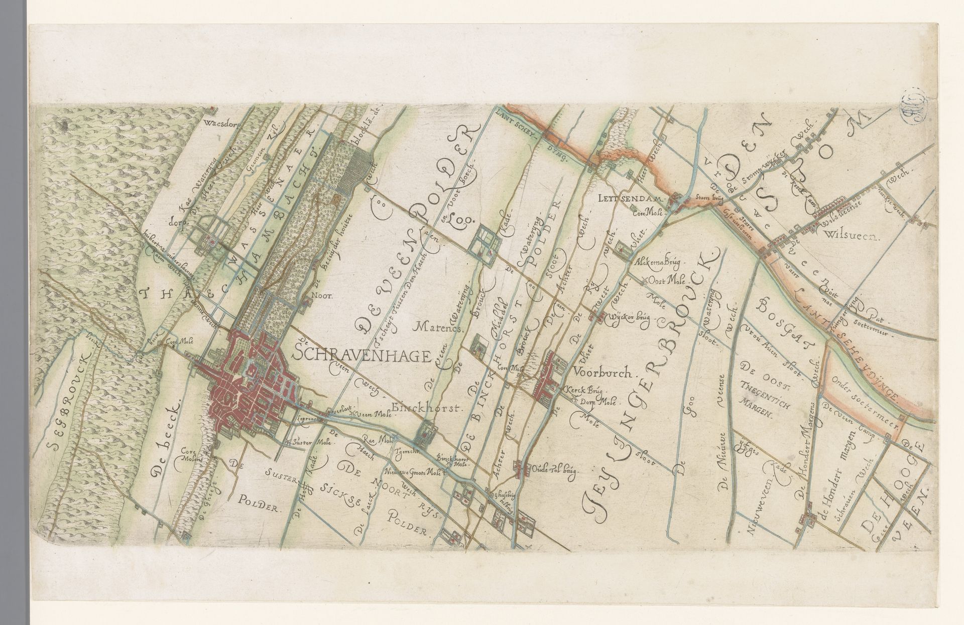
This is a section of a map of the Rijnland water board, including The Hague and its surroundings, made by Floris Balthasarsz van Berckenrode around the turn of the 17th century. At this time, the Dutch Republic was a burgeoning economic power, and maps like this one were not just geographical tools but also instruments of governance and control. This map is closely tied to the social, economic, and political structure of the time. The detailed depiction of polders, for example, reflects the Dutch Republic's innovative water management system. The map offers insight into the economic activities and land use of the region. The careful rendering of property divisions suggests the importance of land ownership and agriculture to Dutch society. To fully appreciate this map, scholars consult local archives and records related to land ownership and water management. Maps like this one remind us that art always exists within broader social and institutional contexts.
Deel van een kaart van het Hoogheemraadschap van Rijnland, met Den Haag en omgeving 1615
Floris Balthasarsz van Berckenrode
1562 - 1616Location
RijksmuseumArtwork details
- Medium
- drawing, paper, ink
- Dimensions
- height 198 mm, width 402 mm
- Location
- Rijksmuseum
- Copyright
- Rijks Museum: Open Domain
Tags
drawing
dutch-golden-age
landscape
paper
ink
cityscape
Comments
No comments
About this artwork
This is a section of a map of the Rijnland water board, including The Hague and its surroundings, made by Floris Balthasarsz van Berckenrode around the turn of the 17th century. At this time, the Dutch Republic was a burgeoning economic power, and maps like this one were not just geographical tools but also instruments of governance and control. This map is closely tied to the social, economic, and political structure of the time. The detailed depiction of polders, for example, reflects the Dutch Republic's innovative water management system. The map offers insight into the economic activities and land use of the region. The careful rendering of property divisions suggests the importance of land ownership and agriculture to Dutch society. To fully appreciate this map, scholars consult local archives and records related to land ownership and water management. Maps like this one remind us that art always exists within broader social and institutional contexts.
Comments
No comments