About this artwork
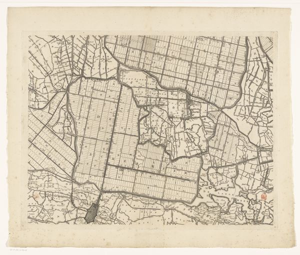
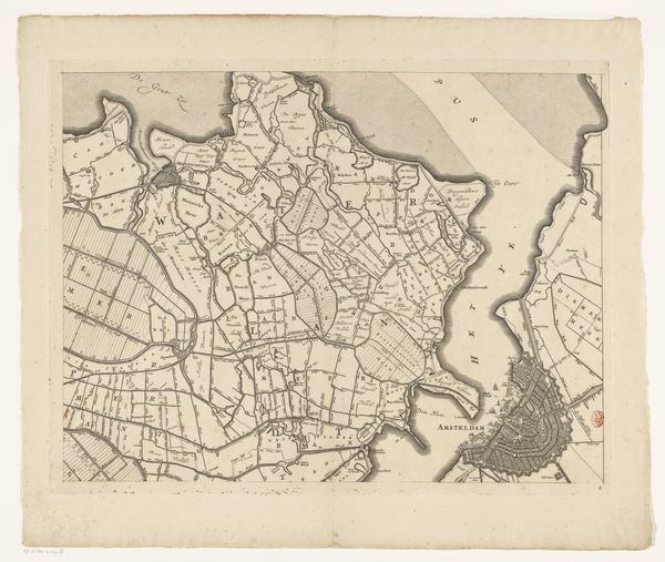
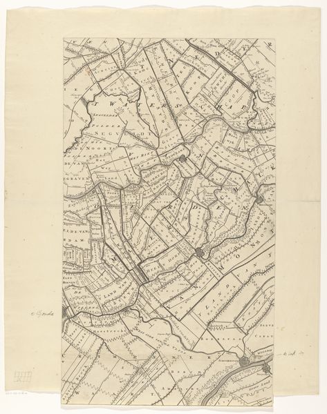
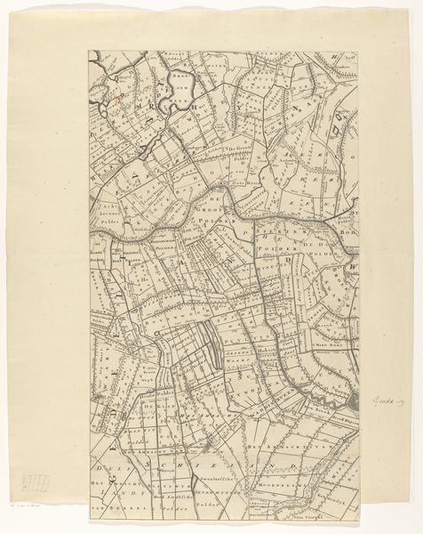
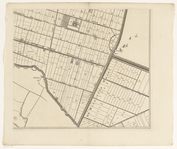
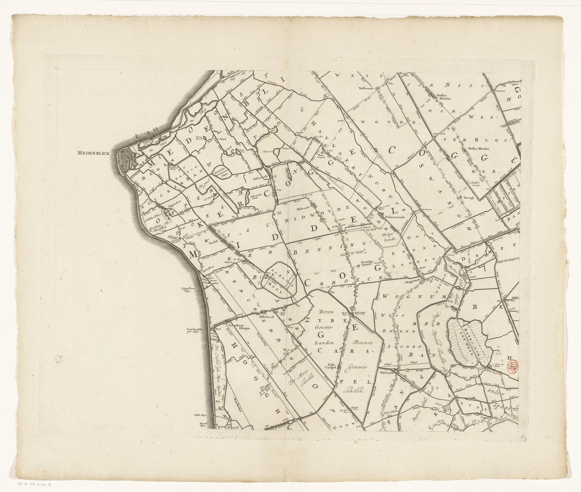
Coenraet Decker produced this map of Kennemerland and West-Friesland sometime in the second half of the 17th century, using etching and engraving. In the Dutch Golden Age, maps were not just navigational tools; they were potent symbols of civic pride, commercial power, and territorial control. The meticulous detail with which Decker depicts the region reflects the Dutch Republic's burgeoning sense of identity and its dominance in global trade. This map underscores the importance of land reclamation and water management to Dutch identity and economic prosperity. Studying the map's iconography, lettering styles, and cartographic conventions helps us understand the cultural values of the Dutch Republic. Resources like city archives, guild records, and period travelogues would offer insights into the map's purpose, reception, and role in shaping Dutch perceptions of their environment. Ultimately, this map reminds us that art is embedded in specific social and institutional contexts.
Kaart van Kennemerland en West-Friesland (zesde deel)
1680
Coenraet Decker
1650 - 1685Location
RijksmuseumArtwork details
- Medium
- print, etching, engraving
- Dimensions
- height 453 mm, width 584 mm
- Location
- Rijksmuseum
- Copyright
- Rijks Museum: Open Domain
Tags
aged paper
dutch-golden-age
pen sketch
etching
old engraving style
hand drawn type
landscape
etching
personal sketchbook
geometric
pen-ink sketch
pen work
sketchbook drawing
sketchbook art
engraving
Comments
Be the first to share your thoughts about this work.
About this artwork
Coenraet Decker produced this map of Kennemerland and West-Friesland sometime in the second half of the 17th century, using etching and engraving. In the Dutch Golden Age, maps were not just navigational tools; they were potent symbols of civic pride, commercial power, and territorial control. The meticulous detail with which Decker depicts the region reflects the Dutch Republic's burgeoning sense of identity and its dominance in global trade. This map underscores the importance of land reclamation and water management to Dutch identity and economic prosperity. Studying the map's iconography, lettering styles, and cartographic conventions helps us understand the cultural values of the Dutch Republic. Resources like city archives, guild records, and period travelogues would offer insights into the map's purpose, reception, and role in shaping Dutch perceptions of their environment. Ultimately, this map reminds us that art is embedded in specific social and institutional contexts.
Comments
Be the first to share your thoughts about this work.