About this artwork
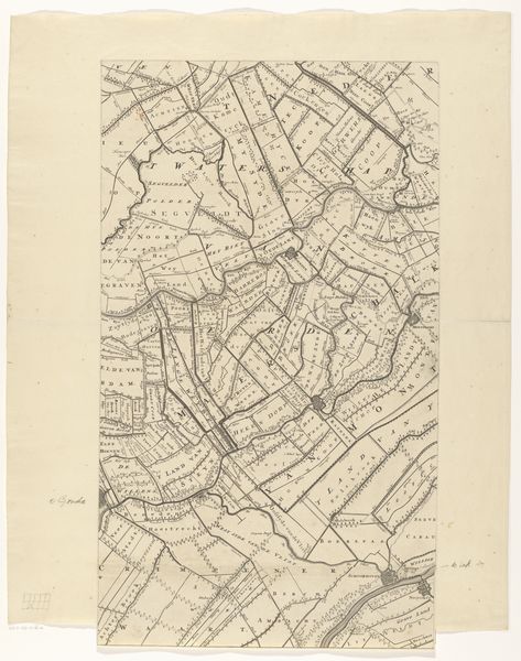
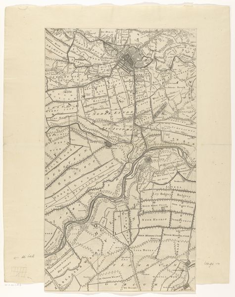
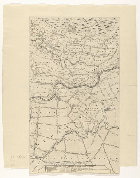
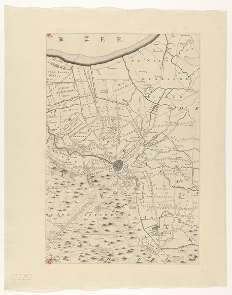
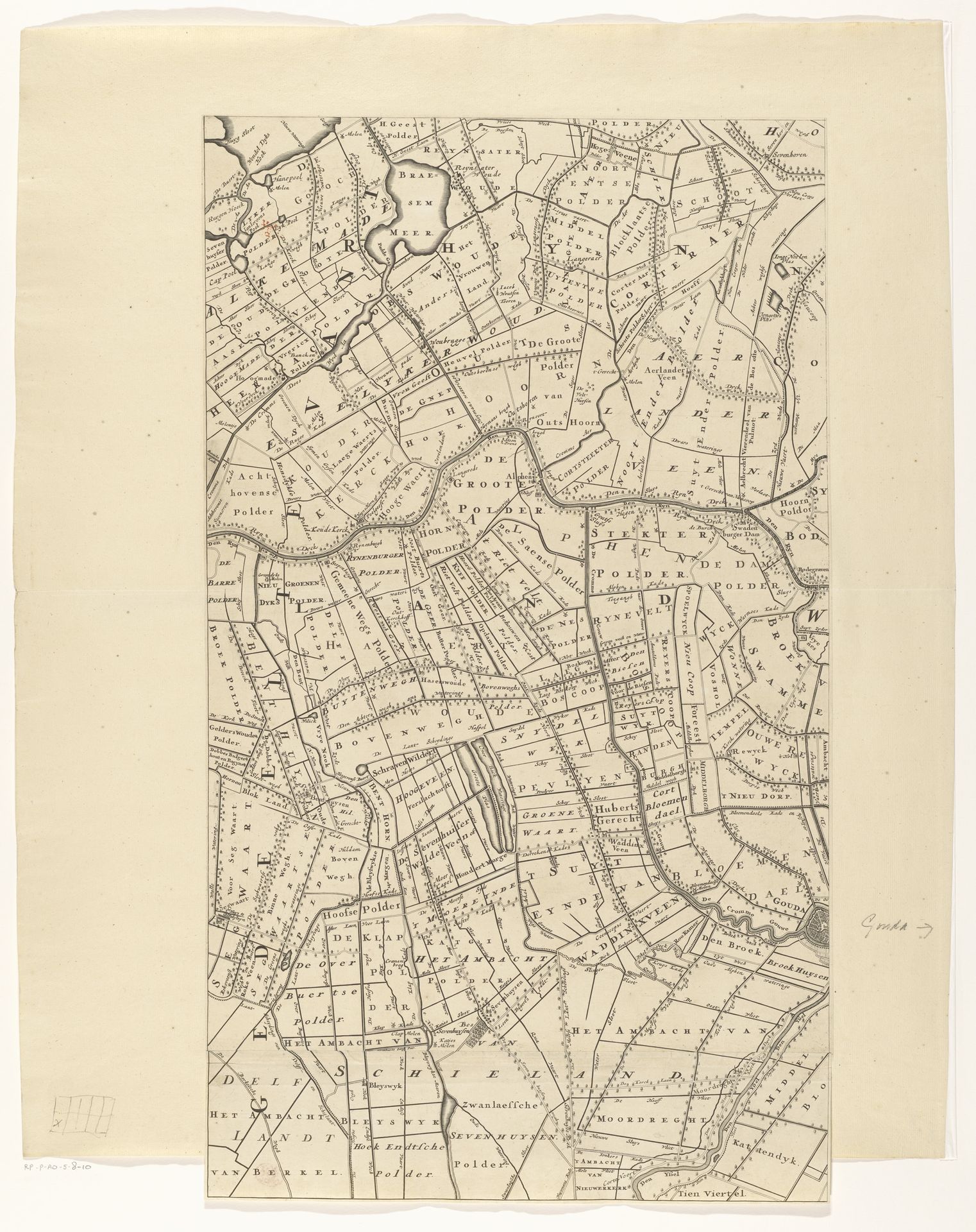
This map of the province of Utrecht was made by Thomas Doesburgh using engraving, a meticulous printing process. Notice the fine lines incised into a metal plate, which would have been inked and pressed onto paper. The crisp precision afforded by engraving was ideal for cartography, where accuracy was paramount. But maps are never neutral; they reflect choices about what to include and how to represent the territory. This map emphasizes the careful division of land, the borders and boundaries that defined property and power. Consider the labor involved in both creating the map and surveying the land it depicts. These processes were crucial to early capitalism, enabling the management and exploitation of resources. So, next time you look at a map, remember it’s not just a representation of space, but a record of human activity and its impact on the land.
Kaart van de provincie Utrecht (eerste deel van onder) after 1696
Thomas Doesburgh
@thomasdoesburghLocation
RijksmuseumArtwork details
- Medium
- print, etching
- Dimensions
- height 643 mm, width 372 mm
- Location
- Rijksmuseum
- Copyright
- Rijks Museum: Open Domain
Tags
dutch-golden-age
etching
landscape
etching
geometric
Comments
No comments
About this artwork
This map of the province of Utrecht was made by Thomas Doesburgh using engraving, a meticulous printing process. Notice the fine lines incised into a metal plate, which would have been inked and pressed onto paper. The crisp precision afforded by engraving was ideal for cartography, where accuracy was paramount. But maps are never neutral; they reflect choices about what to include and how to represent the territory. This map emphasizes the careful division of land, the borders and boundaries that defined property and power. Consider the labor involved in both creating the map and surveying the land it depicts. These processes were crucial to early capitalism, enabling the management and exploitation of resources. So, next time you look at a map, remember it’s not just a representation of space, but a record of human activity and its impact on the land.
Comments
No comments