About this artwork
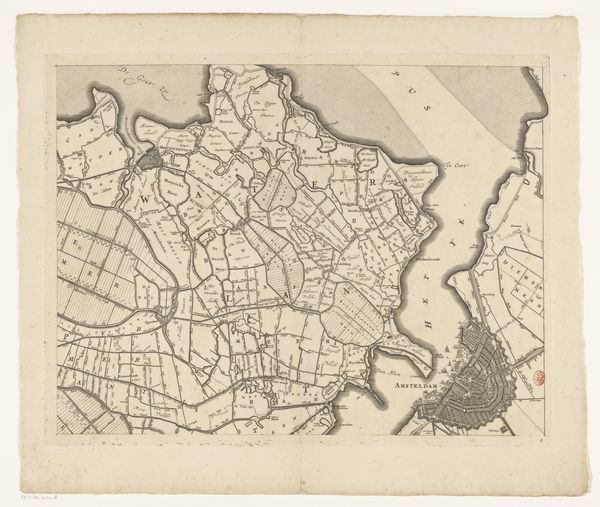
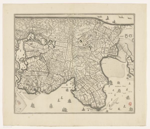
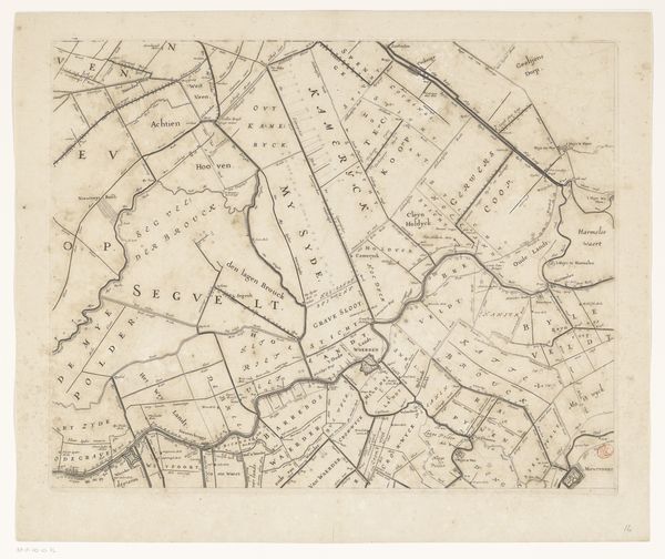
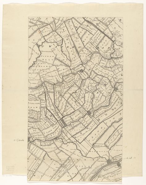
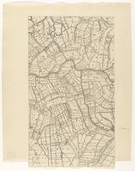
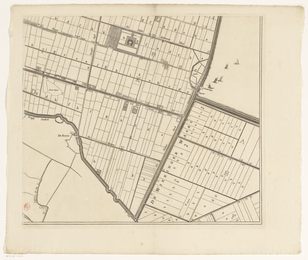
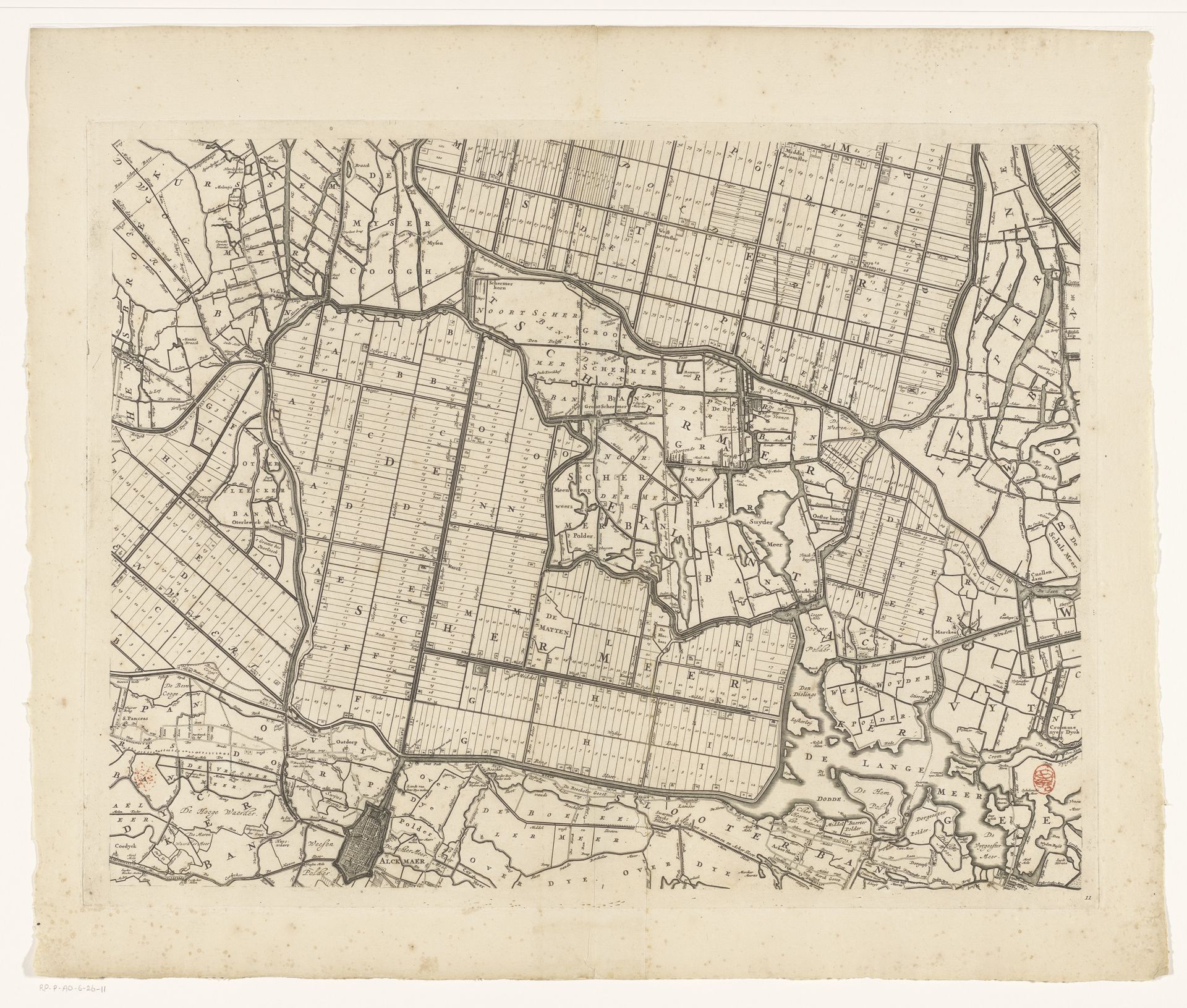
Coenraet Decker created this map of Kennemerland and West-Friesland in the Netherlands in the second half of the 17th century using etching. This map offers insights into the intricate relationship between the Dutch and their landscape. The highly organized layout reflects the Dutch’s efforts to manage and control water through the construction of canals and polders. This landscape wasn't merely geographical, it was deeply interwoven with the Dutch identity, shaped by their constant struggle against the sea. The grid-like structure mirrors a society that valued order and rationality. The map also reveals the economic ambitions of the Dutch Republic. Land was not just territory, but a valuable commodity. Every square inch had the potential to generate wealth through agriculture and trade. Consider how this map is not just a representation of land, but an embodiment of the Dutch spirit of innovation, resilience, and enterprise. It is a document of a people who dared to reshape their world.
Kaart van Kennemerland en West-Friesland (elfde deel)
1680
Coenraet Decker
1650 - 1685Location
RijksmuseumArtwork details
- Medium
- graphic-art, print, paper, engraving
- Dimensions
- height 453 mm, width 590 mm
- Location
- Rijksmuseum
- Copyright
- Rijks Museum: Open Domain
Tags
Comments
Share your thoughts
About this artwork
Coenraet Decker created this map of Kennemerland and West-Friesland in the Netherlands in the second half of the 17th century using etching. This map offers insights into the intricate relationship between the Dutch and their landscape. The highly organized layout reflects the Dutch’s efforts to manage and control water through the construction of canals and polders. This landscape wasn't merely geographical, it was deeply interwoven with the Dutch identity, shaped by their constant struggle against the sea. The grid-like structure mirrors a society that valued order and rationality. The map also reveals the economic ambitions of the Dutch Republic. Land was not just territory, but a valuable commodity. Every square inch had the potential to generate wealth through agriculture and trade. Consider how this map is not just a representation of land, but an embodiment of the Dutch spirit of innovation, resilience, and enterprise. It is a document of a people who dared to reshape their world.
Comments
Share your thoughts