drawing, graphic-art, print, ink, engraving
#
drawing
#
graphic-art
#
toned paper
#
dutch-golden-age
# print
#
pen sketch
#
old engraving style
#
landscape
#
personal sketchbook
#
ink
#
ink drawing experimentation
#
pen-ink sketch
#
ink colored
#
line
#
pen work
#
sketchbook drawing
#
sketchbook art
#
engraving
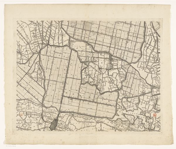
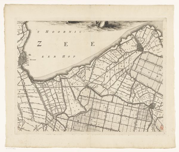
Dimensions: height 453 mm, width 586 mm
Copyright: Rijks Museum: Open Domain
Curator: Here we have “Kaart van Kennemerland en West-Friesland (achtste deel)", created around 1680 by Coenraet Decker. It's currently held at the Rijksmuseum. Editor: The stark detail of the landscape captured in ink has a strange, alienated feel. The cartography aesthetic lends this strange emotional distance, although the human presence is so evident everywhere. Curator: Precisely. Maps throughout time don’t just show land, they reflect the power structures inherent in owning, dividing, and controlling territories. Consider this from a psychological viewpoint: what does it imply when a society seeks to quantify and delineate its very environment? Editor: It is quite a contrast to consider the physical act of surveying and rendering such minute detail from direct work upon the earth. Look closely at the engraving—the paper shows marks of use, the pressed lines… each speaks to the labor necessary to its creation. Curator: And consider how landscapes – especially the land divisions indicated by such labor as you point out– take on symbolic meaning within a culture. Boundaries marked in ink, signifying ownership and power – but at what cost to the collective sense of the land? Is it possible this is even echoed in the lines etched deeply in the plate? Editor: Interesting. I hadn’t considered it that way, but you might have a point about that kind of violence being recorded in the making process. Consider the human endeavor of transforming raw material to create this tool and represent our spatial relationship… This tangible representation of our environment surely reshapes how we even consume land. Curator: Absolutely. It creates a shared cultural schema. Whether used for practical way-finding or displayed as a marker of societal standing, images like these carry layered significance, conditioning how generations view the world. Editor: Well, thinking about it materially, it is amazing how the creation and consumption of mapped boundaries ultimately altered land usage and thus social relations as much as simply mirroring an existing reality. Thanks for your insightful angle. Curator: Likewise! It's these subtle, yet significant aspects of our interaction with art which reveal how truly complex any image's place is in society, from then to now.
Comments
No comments
Be the first to comment and join the conversation on the ultimate creative platform.
More like this