drawing, print, paper, engraving
drawing
aged paper
map drawing
dutch-golden-age
old engraving style
landscape
paper
engraving
Dimensions: height 512 mm, width 593 mm
Copyright: Rijks Museum: Open Domain
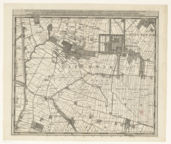
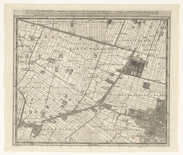
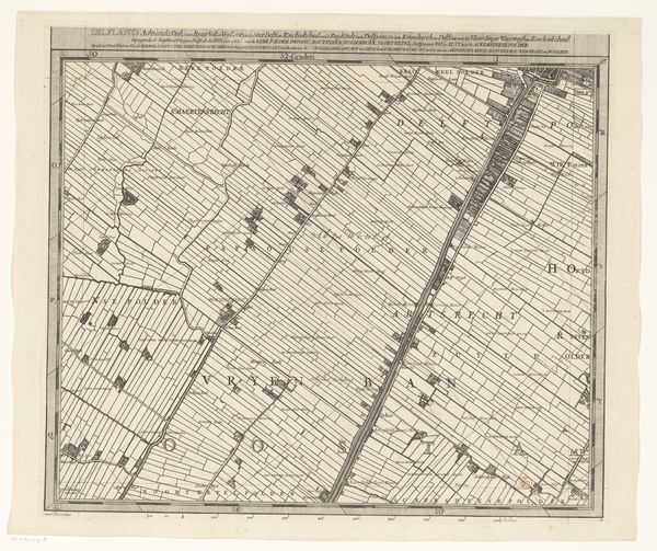
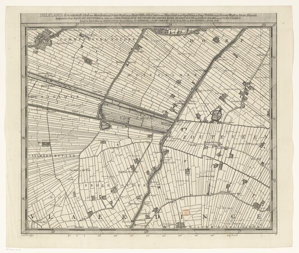
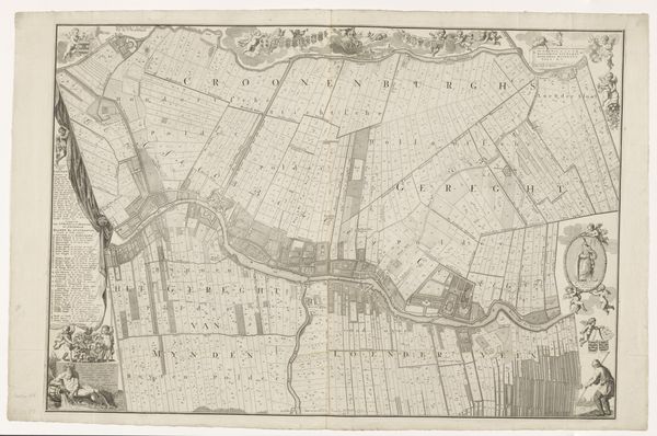
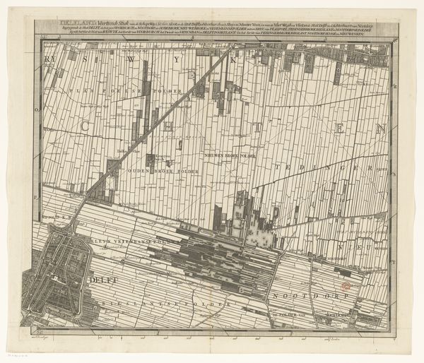
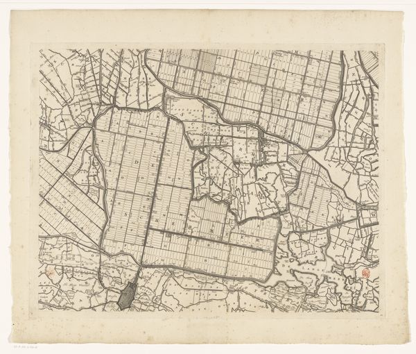
Curator: This is an engraving entitled "Kaart van het Hoogheemraadschap van Delfland (twaalfde deel)," or "Map of the Delfland Water Authority, part twelve." It’s attributed to Luggert van Anse, dating roughly between 1712 and 1735. The materials include print, engraving and paper. Editor: It’s strikingly precise! An almost oppressive order and rationality. Everything carefully mapped out, but rendered in a rather delicate, aged style. What strikes me is how it represents control over the landscape, imposing boundaries and claiming ownership, or maybe it's meant to give us control as viewers? Curator: Precisely. Maps throughout history have served as symbols of power and understanding, representing not just geographic reality but also human ambition. The Delfland Water Authority was, and is, a vital entity managing water resources. So, this map isn't just about physical space. Editor: So we are looking at a declaration, maybe of control over water, a crucial resource in this area? A controlled, tamed, society is presented here? I see an argument that control over environment became associated with control of society itself. Curator: Certainly. Consider the visual language—the grid-like pattern imposed on the land, the precise lettering of place names. These elements reflect a desire for clarity and order. We can link it to Dutch Golden Age ideals. Editor: How so? The Golden Age witnessed incredible economic expansion but also very structured societal hierarchy. A map like this, documenting and partitioning land, resonates with both the prosperity and the inherent inequalities of that period. The desire for land is presented with some violence when viewed with the correct lens. Curator: Good point. Land ownership in the Netherlands was complex and layered during that time. This map could serve as a means to clarify land usage. Moreover, such precision served more than practical purposes; these images bolstered claims of rightful domain through its symbolic depiction. Editor: So, not just navigation but also a subtle instrument of social engineering? Fascinating how a seemingly neutral representation of terrain becomes such a potent cultural document, open to different interpretations throughout history. Curator: Maps remain compelling not just as geographic tools but also as coded documents mirroring evolving power dynamics and cultural priorities. Editor: Exactly, prompting us to rethink how seemingly objective representations are embedded with social power and how such representations can come into conflict when re-viewed through time.
Comments
No comments
Be the first to comment and join the conversation on the ultimate creative platform.