Kaart van het Hoogheemraadschap van Delfland, met Delft en omgeving, middelste deel 1611 - 1692
0:00
0:00
florisbalthasarszvanberckenrode
Rijksmuseum
drawing, print, etching
#
drawing
#
map drawing
#
dutch-golden-age
# print
#
etching
#
landscape
Dimensions: height 383 mm, width 297 mm
Copyright: Rijks Museum: Open Domain
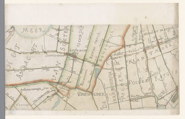
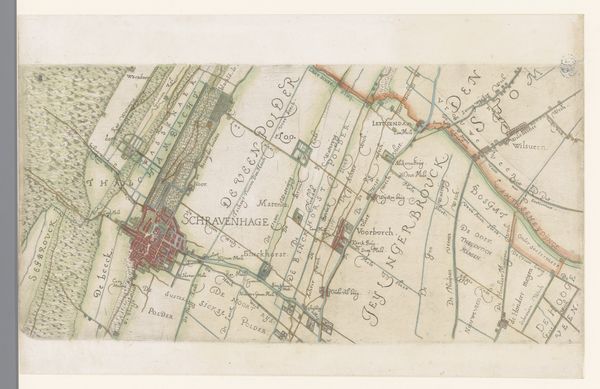
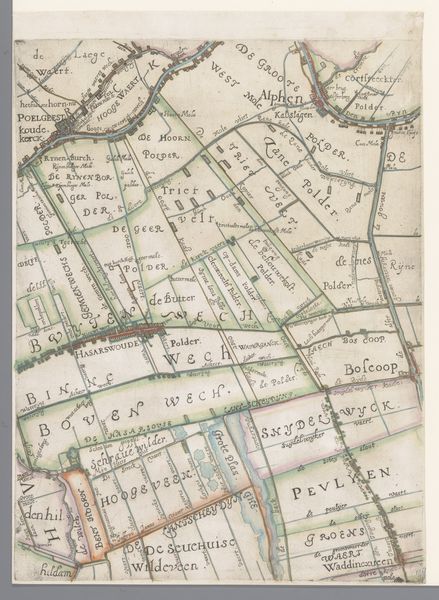
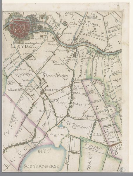
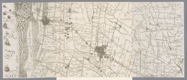
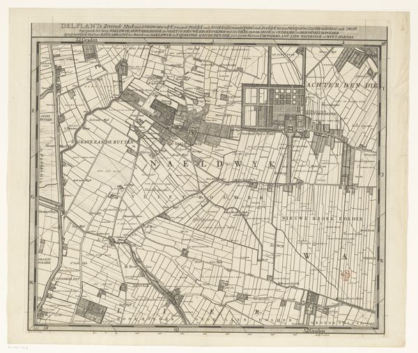
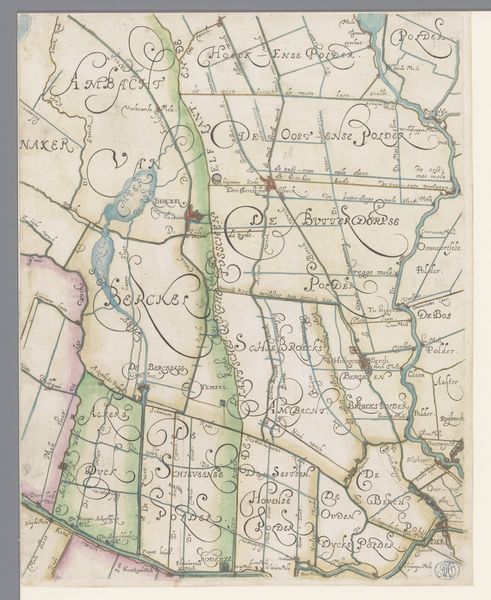
Floris van Berckenrode created this map of Delfland, near Delft, in the Dutch Republic. Maps like this were more than just navigational tools; they were statements of civic and corporate identity. Look closely, and you’ll see the carefully delineated polders. These were areas of reclaimed land, drained and managed collectively. The Hoogheemraadschap, or water board, was a powerful institution responsible for this essential work. By commissioning this map, they were asserting their authority and demonstrating their control over the landscape. Cartography in the Dutch Golden Age was intertwined with economic and political power. It reflected a culture deeply invested in land management and hydraulic engineering. To understand this map fully, we can consult archival records of the Hoogheemraadschap, study contemporary treatises on water management, and compare it with other maps of the period. The meaning of this work resides not only in its lines and colors but in the social and institutional context that brought it into being.
Comments
No comments
Be the first to comment and join the conversation on the ultimate creative platform.
More like this