drawing, print, etching, paper, ink
drawing
dutch-golden-age
etching
landscape
paper
ink
coloured pencil
history-painting
Dimensions: height 164 mm, width 234 mm
Copyright: Rijks Museum: Open Domain
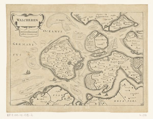
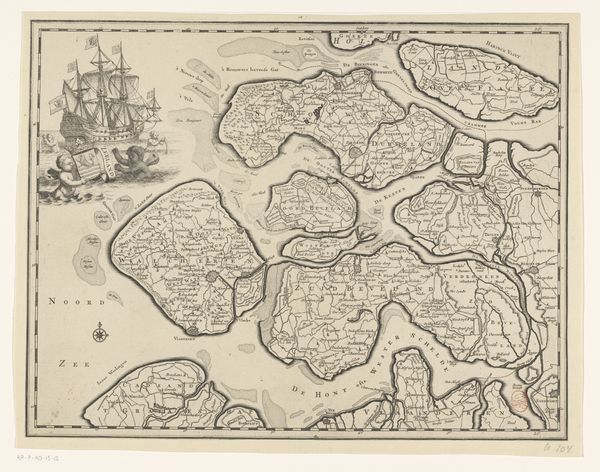
This hand-colored engraving presents a map of Walcheren, a region in the Netherlands, though the exact date and the artist are unknown. The image creates meaning through its visual codes. The settlements, carefully marked, speak to the island’s human geography, and the ships point to its importance for trade and naval power. The map offers a clear representation of space, but its cultural references go deeper than just geography. Made for the Dutch, it embodies their ambition to dominate the seas and expand their empire. Consider the role of institutions such as the Dutch East India Company in promoting such exploration and mapping. Historical maps like this offer a fascinating glimpse into the social conditions that shaped the early modern world. Historians use resources like archival documents, period literature, and other visual materials to understand better the social, economic, and political context in which such maps were created and consumed.
Comments
No comments
Be the first to comment and join the conversation on the ultimate creative platform.