graphic-art, print, etching, paper, engraving
#
graphic-art
# print
#
etching
#
landscape
#
paper
#
coloured pencil
#
cityscape
#
engraving
Dimensions: height 158 mm, width 216 mm
Copyright: Rijks Museum: Open Domain
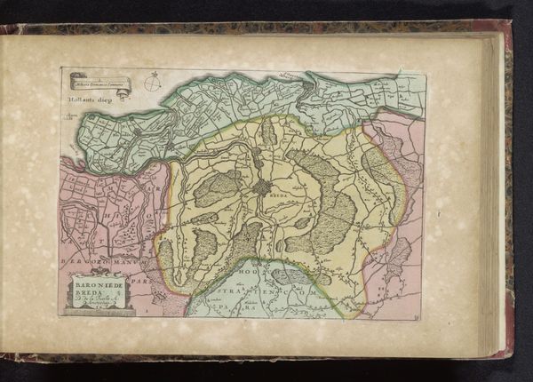
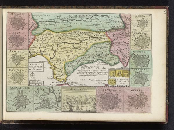
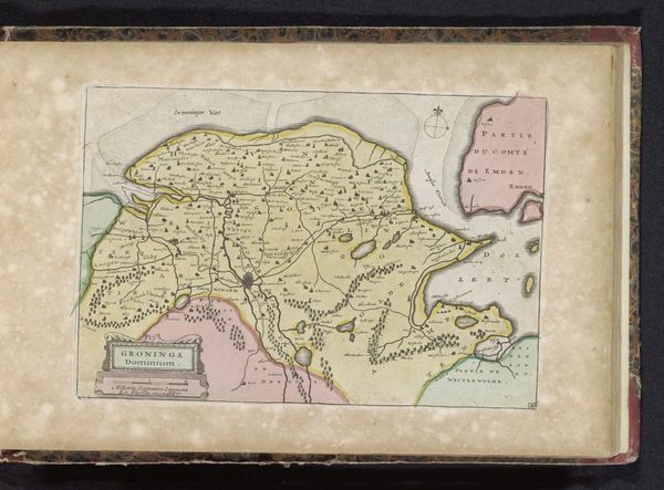
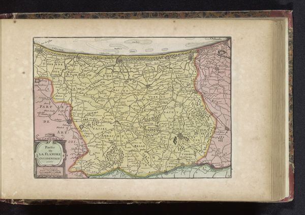
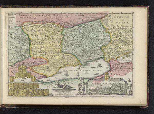
Curator: What immediately grabs me about this work is the intricacy. So much labor must have been required. Editor: Indeed. Let’s delve in. We're looking at an etched and engraved print titled "Kaart van de meierij van 's-Hertogenbosch," meaning a map of the Bailiwick of 's-Hertogenbosch. It's attributed to an anonymous artist and dates roughly to between 1700 and 1735. Curator: It's more than just geography, though, isn't it? See how they’ve coloured some of the areas? It speaks of ownership, control…the raw materials and where they are situated are clearly of importance. Editor: Precisely. These cartographic works served a political function, defining territories and legitimizing claims. Notice the clear delineation between "Partie de Hollande" and other regions; borders marked not only with lines but different colours entirely. The imagery also indicates control by certain cities, showcasing centres of power and trade. Curator: The type of paper would be interesting to examine, its availability, origin… this affected its price. The creation of multiple prints like this surely factored into the economy and how this Bailiwick was regarded by others? It served a function, informing the trade routes for goods being imported and exported across that area. Editor: Absolutely. The distribution networks are important to consider. Were these maps readily available to the public, or were they primarily for the use of the political elite and merchants? Consider also, the institutional aspect – perhaps they were displayed in municipal buildings or used in schools. It speaks to power dynamics, access to information, who was 'in the know’ at this time. Curator: I see your point entirely. If you look closely at how the topography is presented through that detailed process of etching and engraving—that texture gives a sense of not just geographical but economical…possibilities, perhaps? The very act of portraying the landscape transforms the resources into potential value and highlights accessibility, a key thing when thinking of distribution. Editor: In essence, a two-dimensional representation reflecting complex societal realities, right down to distribution methods. Thank you for providing those essential connections. Curator: My pleasure! It all returns to how it’s made and distributed—both of which provide us clues for the reasons as to *why* it was made in the first place.
Comments
No comments
Be the first to comment and join the conversation on the ultimate creative platform.
More like this