drawing, print, pen, engraving
#
drawing
#
pen drawing
#
dutch-golden-age
# print
#
geometric
#
pen
#
engraving
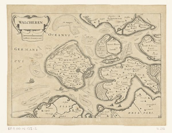
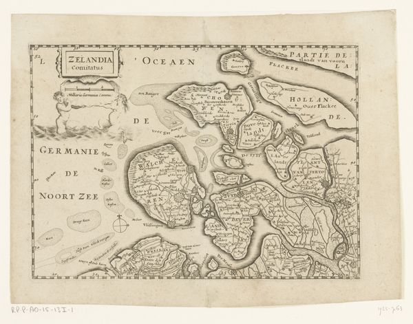
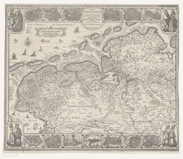
Dimensions: height 331 mm, width 430 mm
Copyright: Rijks Museum: Open Domain
This is an anonymous map of Zeeland, made using engraving techniques. Notice the composition; the islands of Zeeland are rendered with remarkable precision, each contour etched with fine lines that delineate land from water. The lines vary in thickness, a subtle strategy that adds depth, giving the waterways a palpable presence. The map's structure, with its detailed rendering of geographical space, invites us to consider how such cartographic representations shape our understanding of territory and control. Semiotically, the map functions as a system of signs. Place names, boundaries, and symbols are cultural codes, and the presence of a Dutch ship accompanied by cherubs holding a sign, signifies not just a geographical area, but also the assertion of Dutch power. The map challenges fixed meanings, inviting us to see it not just as a factual document, but as a complex interplay of form and ideology.
Comments
No comments
Be the first to comment and join the conversation on the ultimate creative platform.
More like this