graphic-art, print, engraving
#
graphic-art
#
dutch-golden-age
# print
#
landscape
#
geometric
#
engraving
Dimensions: height 466 mm, width 558 mm
Copyright: Rijks Museum: Open Domain
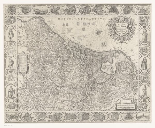
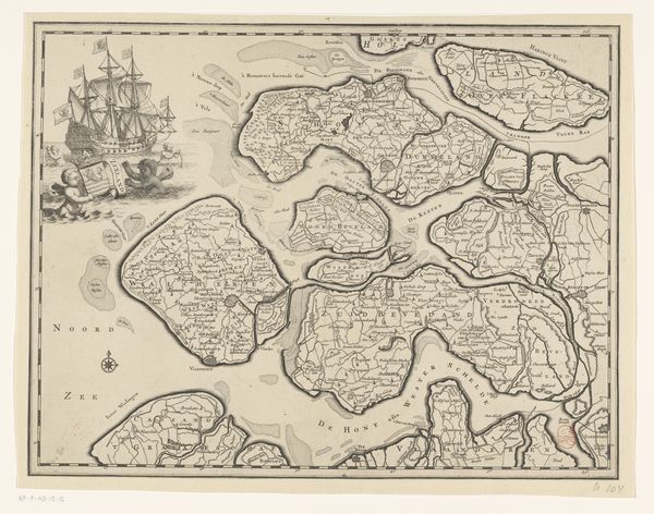
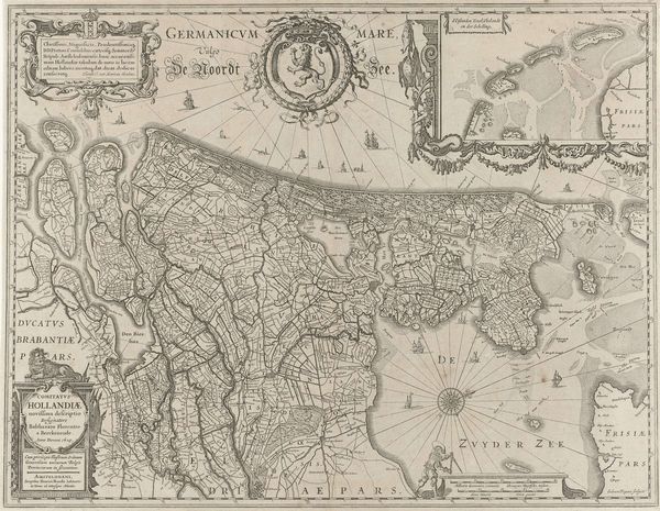
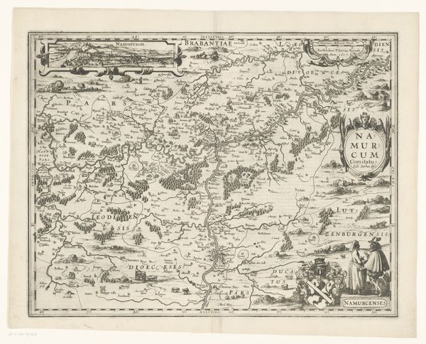
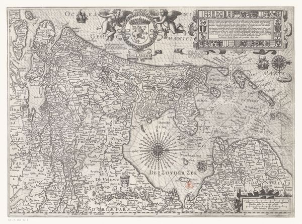
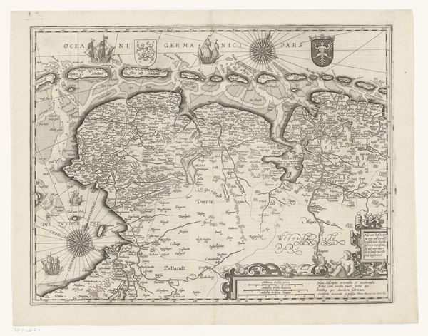
Curator: Here we have Abraham Goos's map of Friesland, Groningen, and East Friesland, dating roughly from 1649 to 1652. It’s a beautifully detailed engraving, offering insight into the geographical understanding of the region during the Dutch Golden Age. Editor: Immediately striking. Look at that intricate coastline, the meticulous depiction of waterways and landmasses! There is a great sense of exploration here. What visual narratives might this evoke? Curator: Well, maps of this era weren’t merely navigational tools. They projected power, shaping perceptions of territory and solidifying claims of ownership in a time of intense competition among European powers. Editor: Certainly, but consider the embedded symbols. The ships battling the seas, the ornate compass rose – these are not just decorative elements. They're potent emblems of trade, dominion, and the prevailing worldview. The geometric precision signifies more than accurate geography; it represents the triumph of reason and order. Curator: Exactly. The inclusion of coats of arms and vignettes showcasing city views and local costumes serves a similar purpose: solidifying identity. Goos crafted a visual argument about this region’s distinctiveness within a broader European context, and the map’s wide circulation reinforces that message. Editor: It is a fascinating representation of human’s ability to impose order on an idea or ideal: not only on paper but on the world at large, quite an aggressive undertaking. Curator: Yes, this wasn’t a neutral representation of landscape, but a tool to actively participate in its structuring through the symbolic work invested on this piece. Its value resides less in its practical cartographic usage and more in its socio-political functions and messages. Editor: True, and understanding those functions enables us to truly read this print; and so to delve a little deeper. It's far more than simply aesthetic. Curator: Indeed. Seeing this map then isn’t merely appreciating its aesthetic or historical value, but also a good opportunity to engage with some crucial questions. Who created this, and to whom? Editor: And more importantly: what unspoken messages is it transmitting across time?
Comments
No comments
Be the first to comment and join the conversation on the ultimate creative platform.
More like this