drawing, print, paper, ink, engraving
#
drawing
#
pen drawing
#
dutch-golden-age
#
mechanical pen drawing
# print
#
pen sketch
#
old engraving style
#
paper
#
ink line art
#
linework heavy
#
ink
#
geometric
#
pen-ink sketch
#
thin linework
#
pen work
#
genre-painting
#
history-painting
#
northern-renaissance
#
early-renaissance
#
engraving
#
realism
#
intricate and detailed
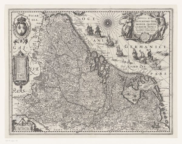
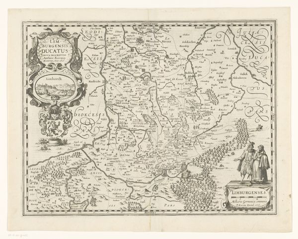
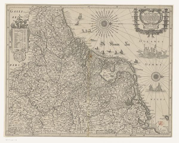
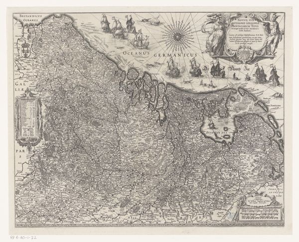
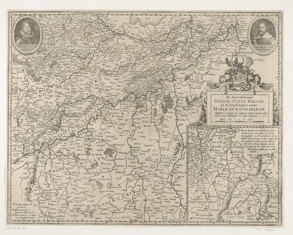
Dimensions: height 490 mm, width 608 mm
Copyright: Rijks Museum: Open Domain
Editor: This is "Kaart van de Nederlanden," a map of the Netherlands from 1631, created by Henricus Hondius. It's an intricate engraving, filled with so much detail. I’m struck by how it presents both geographical information and, seemingly, a statement of power. What are your initial thoughts on this piece? Curator: That's a great observation. As a historian, what jumps out at me is how maps like this served not just as geographical tools, but as powerful statements of identity and political ambition during the Dutch Golden Age. Look at the elaborate borders filled with cityscapes and figures – how do you think that functions? Editor: I guess it frames the Netherlands as this wealthy, powerful entity by highlighting its cities and important people? Curator: Precisely! It’s visual propaganda, asserting Dutch control and prosperity at a time of immense social and political change, particularly during the Eighty Years' War. Notice the cartouche, the elaborate title piece, acting almost like a coat of arms. Think about what symbols Hondius includes and why. Also, what is your interpretation of placing the images of important people and the landscapes on the sides of the map? Editor: Well, I hadn’t really thought of the map as propaganda. It's interesting to see how much historical and political context can be embedded within something that seems purely informational. The detailed border images show how strategic locations function like a shield of power to protect the land? It's almost a declaration. Curator: Exactly! This map embodies the burgeoning Dutch Republic, visually broadcasting its commercial strength and political prowess. How do you view the museum displaying it? Editor: It encourages an interpretation of cartography as art. It adds an element to think about while navigating the Netherlands today and reflect on the rich cultural heritage that this "drawing" encapsulates. Curator: Indeed. And considering the history it represents gives it even more power now.
Comments
No comments
Be the first to comment and join the conversation on the ultimate creative platform.
More like this