print, engraving
#
dutch-golden-age
# print
#
old engraving style
#
landscape
#
geometric
#
engraving
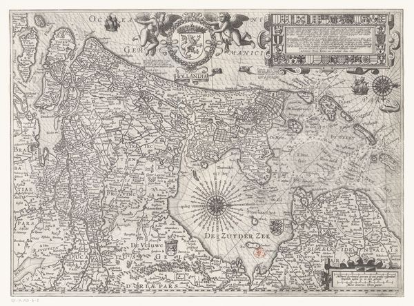
Dimensions: height 430 mm, width 545 mm
Copyright: Rijks Museum: Open Domain
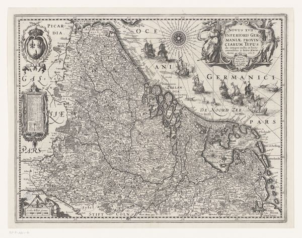
Curator: Here we have Abraham Goos' "Kaart van de Zeventien Provinciën," an engraving created sometime between 1630 and 1645. Look closely at the intricate detail. Editor: It’s beautiful in a very controlled, almost severe way. All those tiny lines make it seem incredibly precise, yet distant. Like viewing a world meticulously constructed, but not necessarily felt. Curator: Well, precisely! It's a map, but it also operates as a political document. The Seventeen Provinces represented the historical Netherlands, before their division in the Dutch Revolt. So the act of mapping was, inherently, a claim to a unified identity. Editor: I see that. There’s a kind of power in fixing territories like this. Who decided these were the seventeen? And how much of it was wishful thinking during a time of conflict and shifting alliances? Mapping isn't neutral, it's making a statement. Curator: Absolutely. Goos was part of a long tradition of Dutch cartography, a field intertwined with trade, exploration, and, yes, political ambition. This map showcases the region’s economic importance through its detailed ports and trade routes. Editor: It feels so different from our relationship to maps today, where GPS does everything. Here, the mapmaker is creating something almost… mythical. You know, there's something deeply satisfying about seeing old methods of measurement when it comes to cartography. A physical and tangible expression of curiosity. It stands as an embodiment of what progress meant at one point in time. Curator: Right, and maps like these weren’t just functional, they were also collected as artworks. To own this map was to possess a certain vision of the world and a statement of your place in it. Editor: I wonder who owned this one. And what did it mean to them beyond just directions and distances? Curator: It sparks so many questions, doesn’t it? It bridges history, politics, and aesthetics. Editor: Definitely. It’s a stark reminder that even something as seemingly objective as a map is loaded with stories, biases, and the desires of its time.
Comments
No comments
Be the first to comment and join the conversation on the ultimate creative platform.
More like this