Curatorial notes
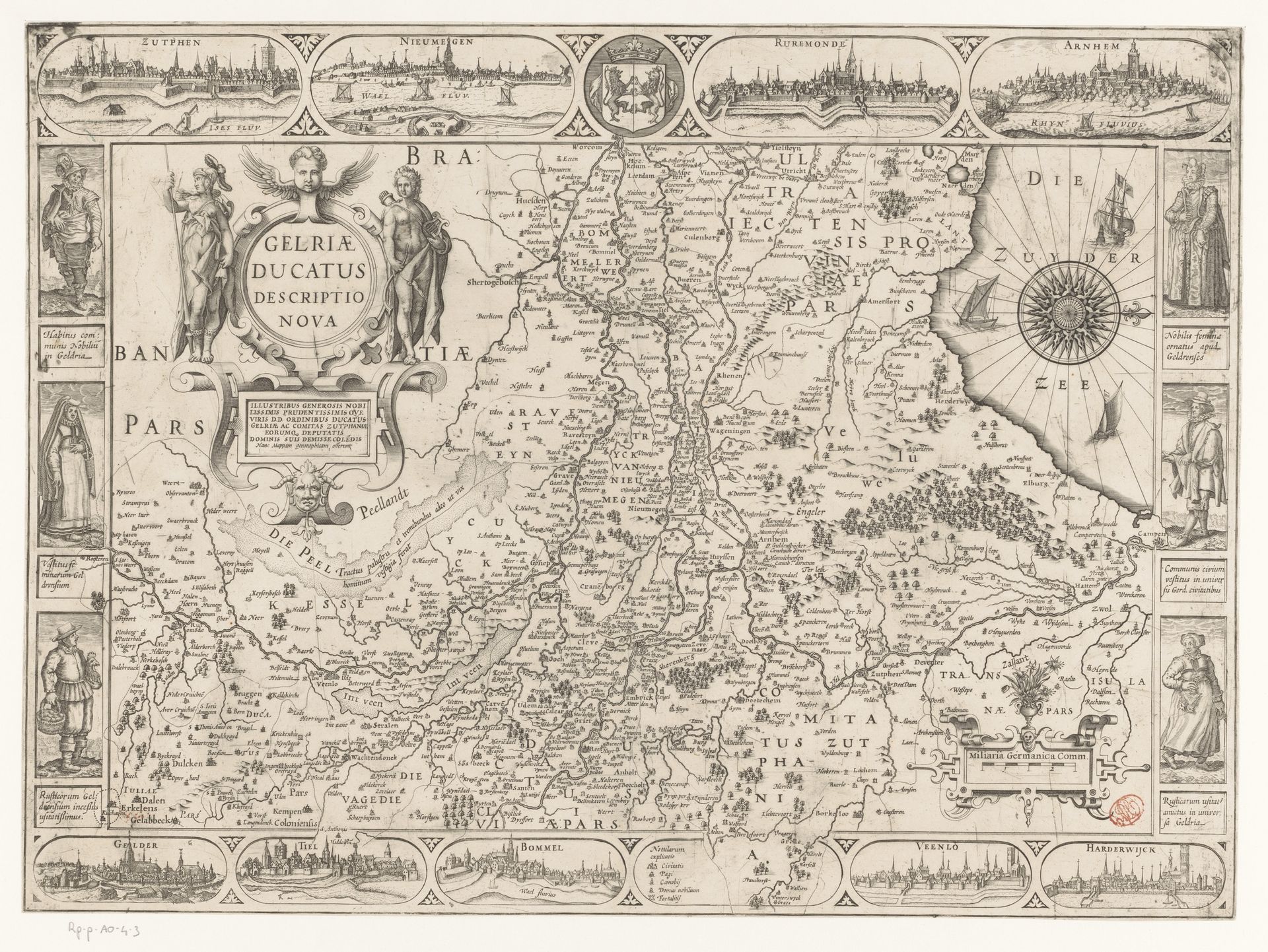
Curator: Here we have "Kaart van Gelderland," a map of Gelderland made after 1617. It's an engraving, probably using ink. It's fascinating to consider maps as art objects. Editor: Absolutely! I am struck by how much information it holds while still feeling quite decorative, almost like a tapestry. What do you see when you look at this? Curator: Well, as a historian, I immediately think about the socio-political context. Maps weren’t just geographical tools; they were statements of power, claims to territory. Who commissioned this, and why? The very act of mapping implies a kind of control. Notice the cityscapes along the top and bottom—they depict centers of power, almost like claiming them through representation. What purpose did they serve to the Dutch elite? Editor: That makes a lot of sense. So, even this meticulous detail… it’s not just about accuracy? Curator: Accuracy was certainly a factor, but the visual language serves political aims. The embellishments—the figures along the sides, the elaborate cartouches—these aren't just for show. They are actively constructing a specific image of Gelderland. What does this representation do to reinforce Dutch identity or power? How might people in different social positions view this map? Editor: So, a seemingly straightforward map is actually deeply embedded in its historical moment. The more I learn, the more I see that the meaning isn't just *in* the art, it's *around* it, too. Curator: Precisely. Art never exists in a vacuum.