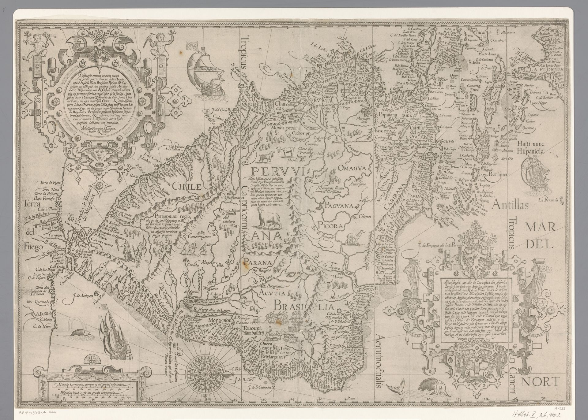
1581 - 1644
Kaart van Zuid-Amerika
Arnold Floris van Langren
1571 - 1644Location
RijksmuseumListen to curator's interpretation
Curatorial notes
Arnold Floris van Langren created this map of South America in the late 16th or early 17th century using engraving. At the time, the Dutch Republic was expanding its global presence through trade and colonization, and cartography was not just a science, but a tool of empire. This map reflects the cultural biases and power dynamics inherent in the European exploration of the Americas. Indigenous territories are labeled with European names, reflecting a claim of ownership and a superimposition of European identity onto the land. Note how the map's visual language is not merely descriptive, but assertive, designed to stake a claim. Although Van Langren probably never set foot in South America himself, his map would have been a key resource for merchants, explorers, and colonial administrators. This object then is more than just a map - it's a cultural artifact, loaded with the desires, ambitions, and prejudices of its time.