drawing, print, ink, engraving
#
drawing
#
baroque
# print
#
pen sketch
#
landscape
#
ink
#
engraving
Dimensions: height 450 mm, width 543 mm
Copyright: Rijks Museum: Open Domain
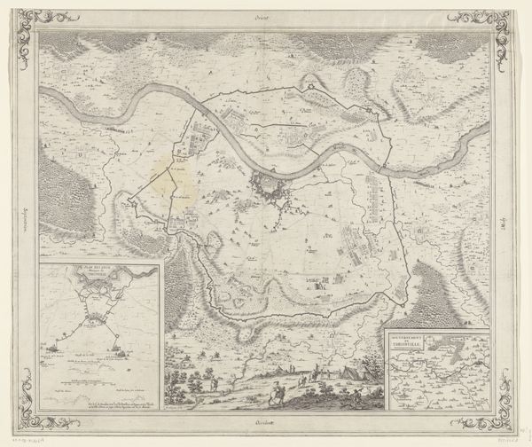
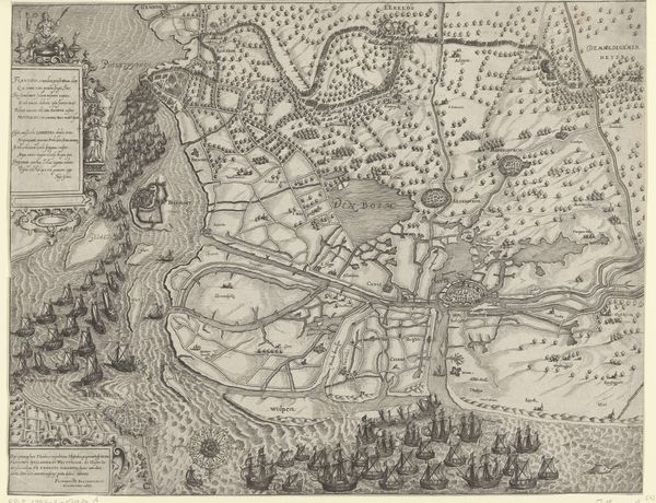
This is an undated etching of Watten, a town in Northern France, made by an anonymous artist. The image is a plan of the town that emphasizes its fortifications, reflecting its strategic importance during a period marked by frequent conflicts. The elaborate detail given to these defensive structures, reveals a society preoccupied with military security. Consider the cultural context: this map was made during a time of shifting political alliances and military campaigns in Europe. The geographical accuracy suggests the influence of emerging scientific cartography, even as the decorative elements remind us of older traditions of mapmaking. The map acts as a kind of political propaganda, underlining the town's significance. As historians, our task is to look beyond the surface and consider the various forces that shaped its creation. Examining archival records, military histories, and period maps can provide deeper insight into the social and institutional dynamics at play. Artworks like these help us understand the relationship between art, power, and society.
Comments
No comments
Be the first to comment and join the conversation on the ultimate creative platform.
More like this