print, engraving
#
baroque
#
pen drawing
# print
#
pen illustration
#
pen sketch
#
old engraving style
#
landscape
#
history-painting
#
engraving
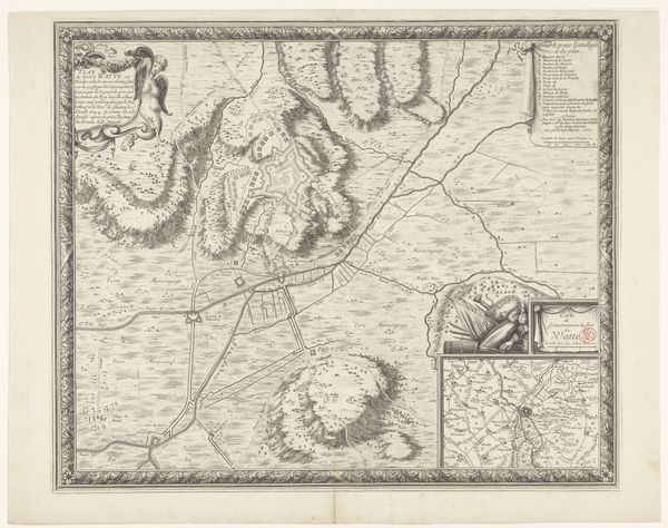
Dimensions: height 505 mm, width 598 mm
Copyright: Rijks Museum: Open Domain
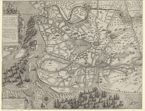
François Collignon created this print titled, *Kaart van het beleg van Thionville*, in 1643. It’s an intricate map rendered in fine lines, offering a bird's-eye view of a siege. The composition is carefully structured around the river, which divides the space and guides the eye through the strategic layout of fortifications and troop placements. The map presents us with a structured, almost geometric, representation of conflict. Each line, each carefully placed symbol, signifies military strategy and territorial control. Semiologically, the map functions as a coded representation of power. The lines defining borders, the symbols denoting military units, and the elevated perspective are all signs of authority and control. It challenges fixed meanings by presenting a dynamic view of a territory under siege, reflecting the instability and flux inherent in warfare. It invites us to question the nature of borders, territories, and the very act of mapping as a form of control.
Comments
No comments
Be the first to comment and join the conversation on the ultimate creative platform.
More like this