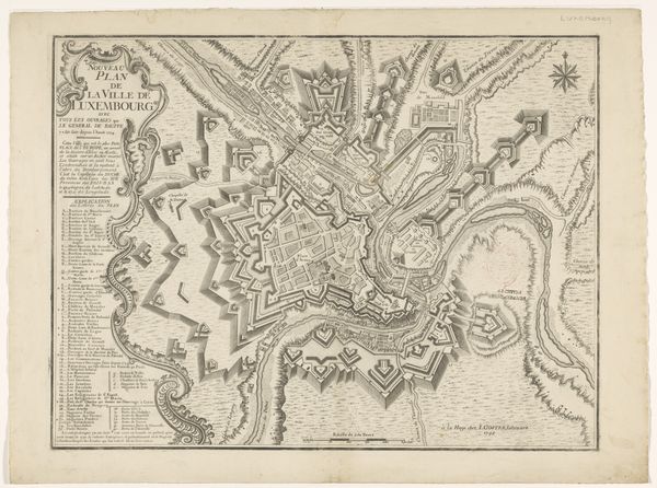
Curatorial notes
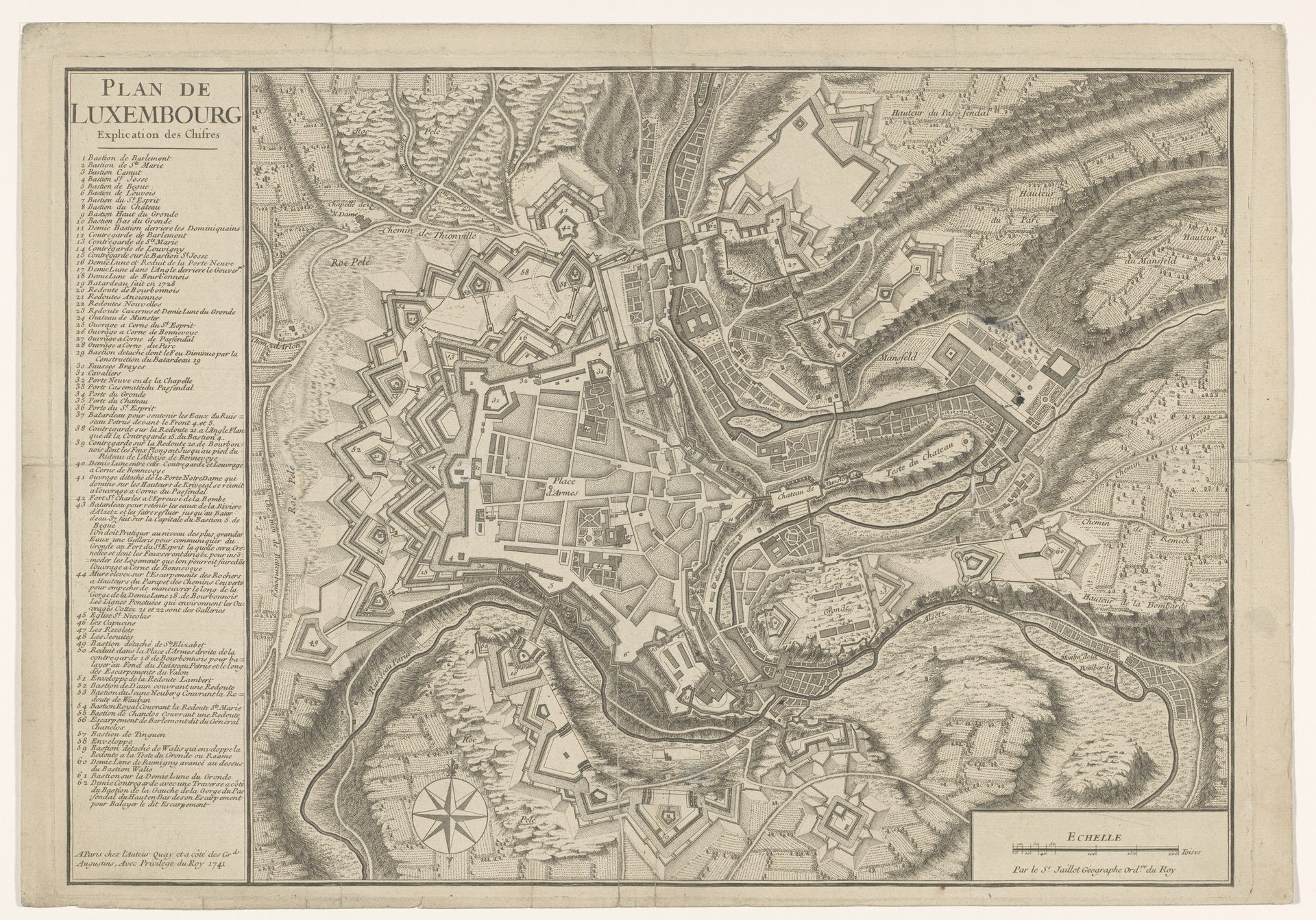
This is an anonymous, undated map of Luxembourg, likely created as an instrument of military power and territorial claim. Consider the map not just as a geographical document, but as a narrative of control. Luxembourg, historically a strategic fortress, found itself at the crossroads of European powers. This map, with its detailed fortifications, speaks volumes about the region's military importance and the constant power struggles for its possession. But what stories are missing from this supposedly objective representation? Whose homes were demolished to build these fortresses? Whose labor was conscripted to defend them? Maps like these, while appearing neutral, were tools for those in power, shaping not only the land but also the lives of its inhabitants. It is a reminder that every map tells a story, but it is up to us to ask: whose story is it, and who is left out?