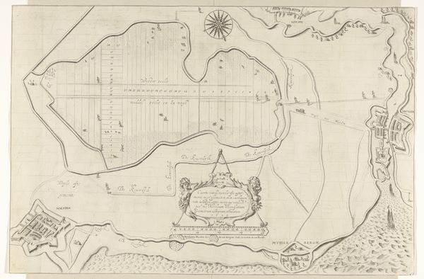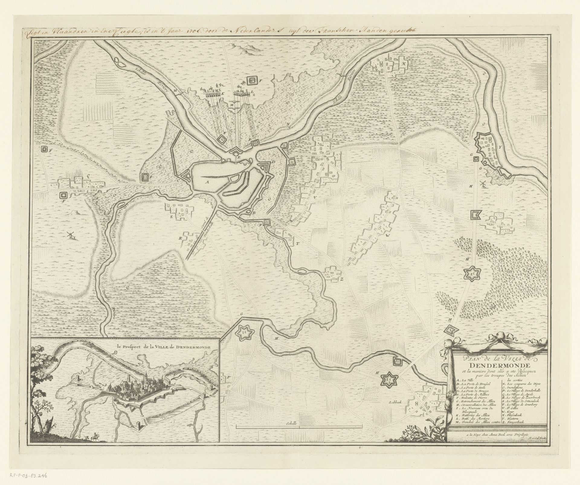
1706
Kaart van het beleg van Dendermonde, 1706
Pieter van (II) Call
1688 - 1737Location
RijksmuseumListen to curator's interpretation
Curatorial notes
Pieter van Call the Younger created this map of the siege of Dendermonde in 1706. Its linear precision creates an engaging visual, emphasizing the strategic layout of military fortifications. The map's structure visualizes power and control. Call uses line and form to highlight Dendermonde's defenses, transforming landscape into a structured tableau of authority. Key to this representation is the geometric precision, turning organic space into ordered form. The rivers and terrains are not merely natural features but elements of military strategy. This structured approach resonates with semiotic theories where the visual elements act as signs within a system. Call is not simply documenting but interpreting, imposing a clear, rational order that reduces the chaos of conflict to comprehensible data. The artwork uses space and form to suggest underlying structural principles of power and strategic thinking. Appreciating this map involves recognizing that visual representation organizes and interprets the world around us.