print, etching
# print
#
etching
#
etching
#
geometric
#
cityscape
Dimensions: height 421 mm, width 523 mm
Copyright: Rijks Museum: Open Domain
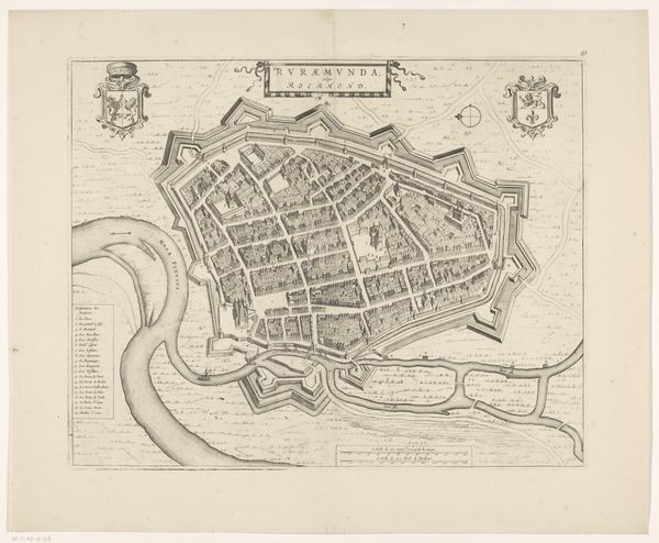
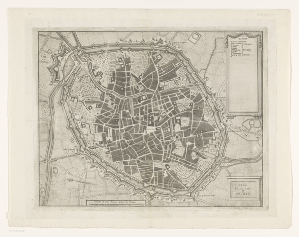
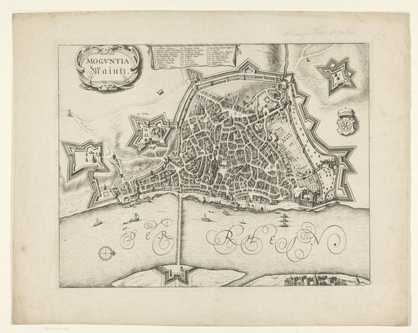
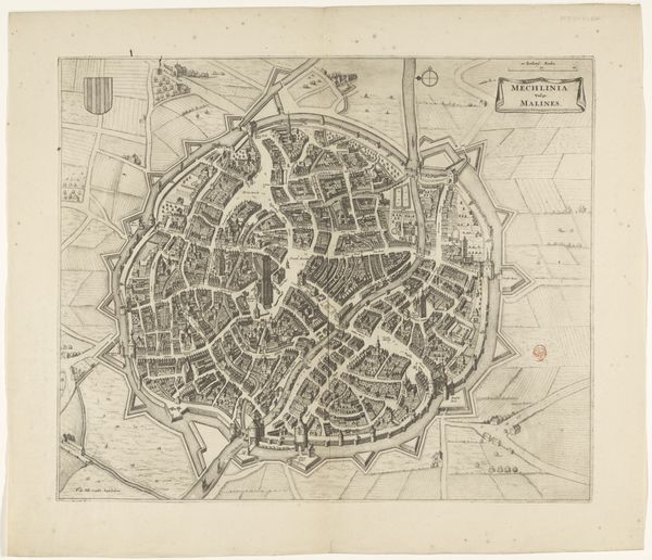
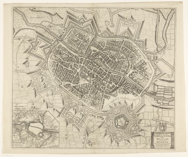
This is an undated map of Cambrai by an anonymous artist, rendered with meticulous detail using engraving. The tight lines and intricate hatching create a dense network of visual information, giving the city an almost organic quality, contained within geometric fortifications. The map functions on multiple levels. At first glance, it's a precise, technical drawing, yet the stark contrast between the black lines and the white paper transforms it into an abstract study of form and space. The rigid structure of the fortifications is juxtaposed with the organic layout of the city, reflecting the tension between order and chaos that defines urban space. The detailed rendering of buildings and streets creates a semiotic code, offering not just a representation of space but also a reading of the city's social and political structures. The map serves not only as a tool for navigation or military strategy, but also as a symbolic representation of power, knowledge, and control. The act of mapping becomes an act of defining, structuring, and ultimately controlling space.
Comments
No comments
Be the first to comment and join the conversation on the ultimate creative platform.
More like this