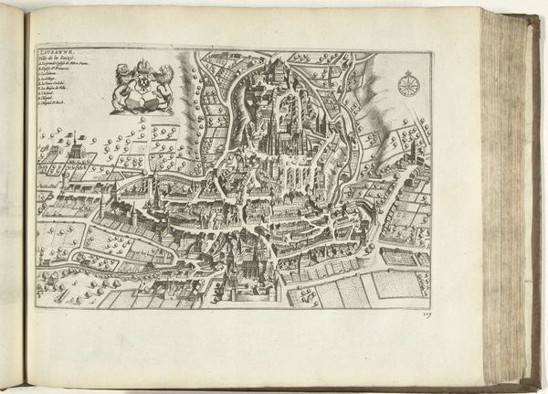
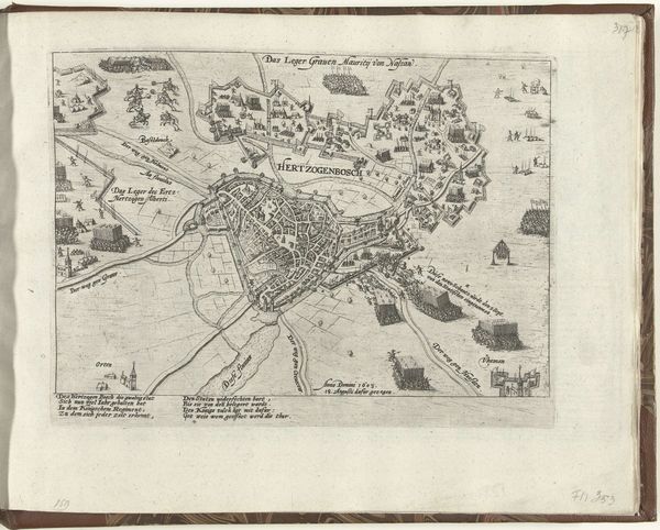
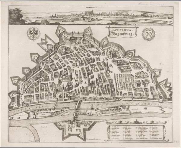
print, engraving
#
baroque
# print
#
old engraving style
#
personal sketchbook
#
ink drawing experimentation
#
geometric
#
line
#
cityscape
#
engraving
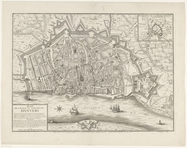
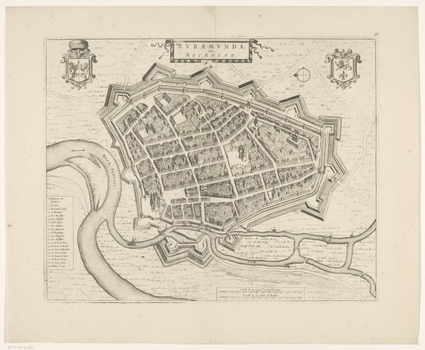
Dimensions: height 401 mm, width 511 mm
Copyright: Rijks Museum: Open Domain
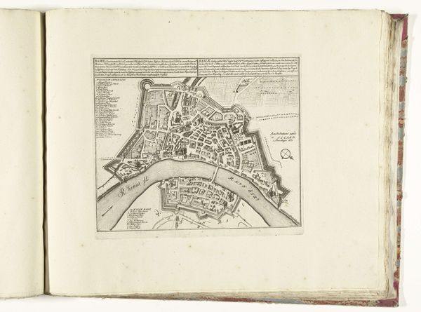
Editor: This is "Plattegrond van Mainz," an engraving dating back to somewhere between 1657 and 1690. It's anonymous, and part of the Rijksmuseum collection. I'm struck by how meticulously detailed it is; every building and street seems accounted for. What leaps out at you when you look at it? Curator: You know, what fascinates me is how it blends the objective and subjective. It's ostensibly a map, meant to be factual. Yet, those elaborate, swirling calligraphic flourishes naming the Rhine River – they’re almost… theatrical. It makes me wonder who this map was for. Was it purely utilitarian, or was there an element of civic pride, perhaps even propaganda involved? Think about it; these were turbulent times, riddled with wars and shifting alliances. Do you see those star-shaped fortifications? They’re not just cartographic details; they're a statement of power, security, control. It speaks volumes, doesn't it? Editor: Definitely! I hadn't considered that. I was so focused on the visual accuracy that I overlooked the potential message. So, the artist, by including those details, is not just showing us the city, but also telling us something about its political climate? Curator: Precisely! Art, even in the guise of a map, is rarely neutral. It’s like finding a hidden poem tucked inside an instruction manual. Now, zoom in on the individual buildings; what do they whisper to you? Editor: Wow, now I feel like I’m actually exploring old Mainz myself, looking up from the cobblestones. Thanks to you I now look at this piece with new eyes. Curator: And I find myself wondering: what would Mainz look like mapped today, and how would it differ? Intriguing thought, no?
Comments
No comments
Be the first to comment and join the conversation on the ultimate creative platform.
More like this