drawing, print, ink, engraving
#
drawing
#
baroque
#
pen drawing
# print
#
ink line art
#
ink
#
geometric
#
cityscape
#
engraving
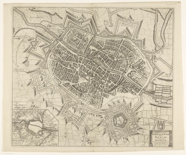
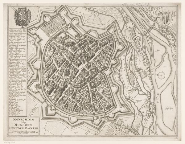
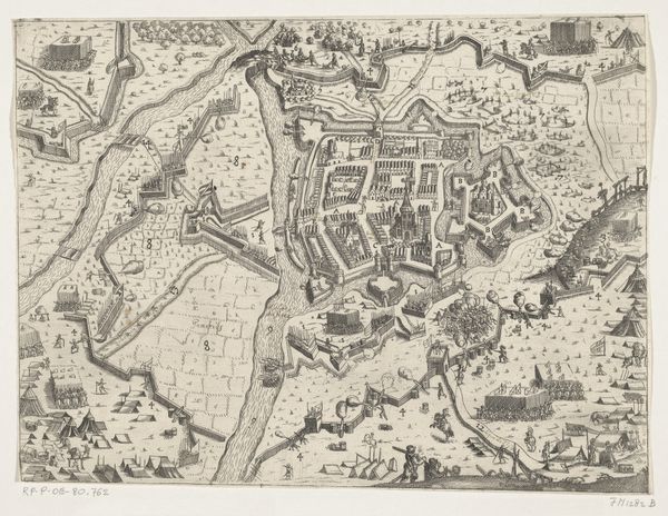
Dimensions: height 475 mm, width 604 mm
Copyright: Rijks Museum: Open Domain
This is an anonymous map of Lille, made with etching. The intricate network of lines creates a visually dense and complex image. The most striking aspect is the star-shaped fortifications surrounding the city, which create a strong sense of enclosure and containment. The geometric precision and repetition of these shapes emphasize the order imposed upon the urban landscape. The map uses a semiotic language of lines and symbols, transforming the physical space of Lille into a structured system of information. This representation abstracts the city, reducing it to a set of signs that communicate its layout, defenses, and strategic importance. The fortifications, rendered with meticulous detail, serve as visual markers of power and control. This map is not merely a representation of space but an assertion of dominance, reflecting broader concerns about territory and security. It offers insights into the historical and political context of Lille. It invites us to decode the layers of meaning embedded in this seemingly straightforward representation.
Comments
No comments
Be the first to comment and join the conversation on the ultimate creative platform.
More like this