print, paper, engraving
#
baroque
# print
#
landscape
#
paper
#
coloured pencil
#
geometric
#
history-painting
#
engraving
Dimensions: height 178 mm, width 255 mm
Copyright: Rijks Museum: Open Domain
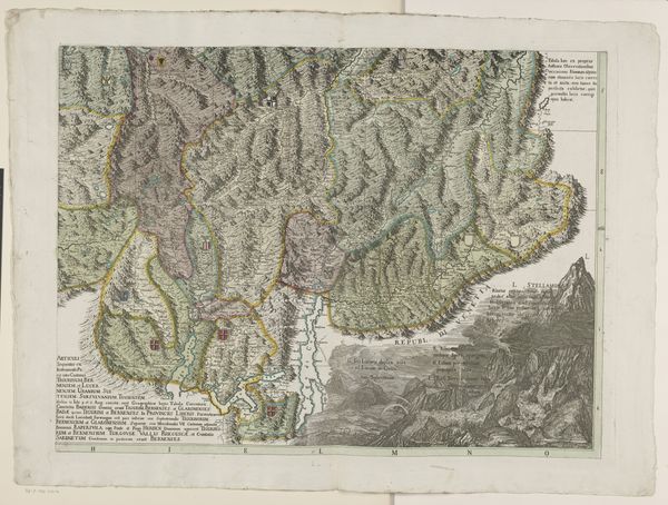
This is an anonymous rendering of "Kaart van de drie valleien van Piemont", or "Map of the three valleys of Piedmont". Historical maps such as this one are not just geographical tools, they also reflect how power and identity are mapped onto the land. Looking at this map, we can consider how the valleys of Piedmont were understood, organized, and represented in the cultural imagination. Consider the role of cartography in shaping perceptions of space and place. Who was this map intended for, and what narratives did it construct about this region? What does it mean for a map like this to be anonymous? This perhaps speaks to the communal nature of knowledge production, or the erasure of individual contributions in favor of a unified vision. As you observe the details of the map—the mountains, rivers, and settlements—reflect on the stories it tells about human interaction with the environment. How does the map portray the relationship between the inhabitants and their surroundings? Ultimately, this map invites us to consider how landscapes are not merely physical spaces, but also cultural constructs imbued with meaning, history, and power.
Comments
No comments
Be the first to comment and join the conversation on the ultimate creative platform.
More like this