1684 - 1701
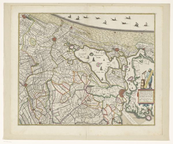
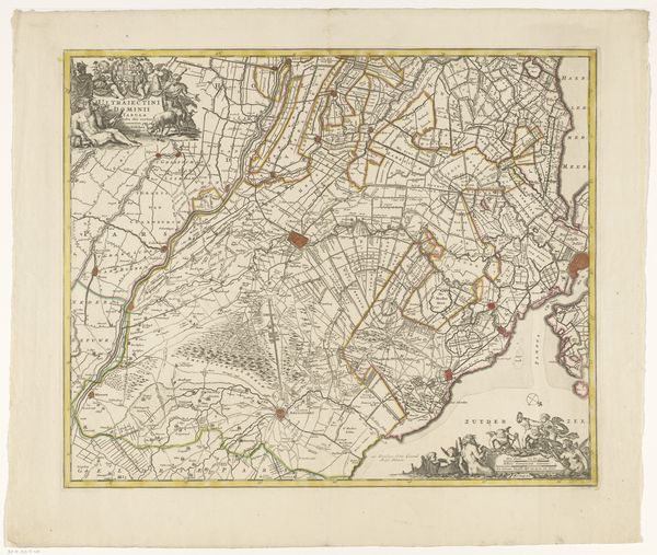
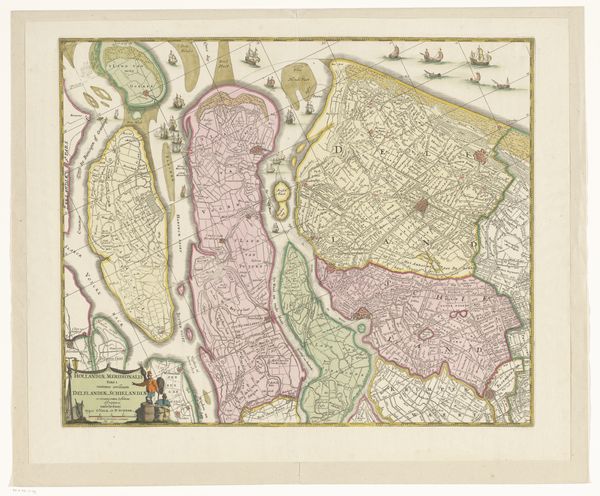
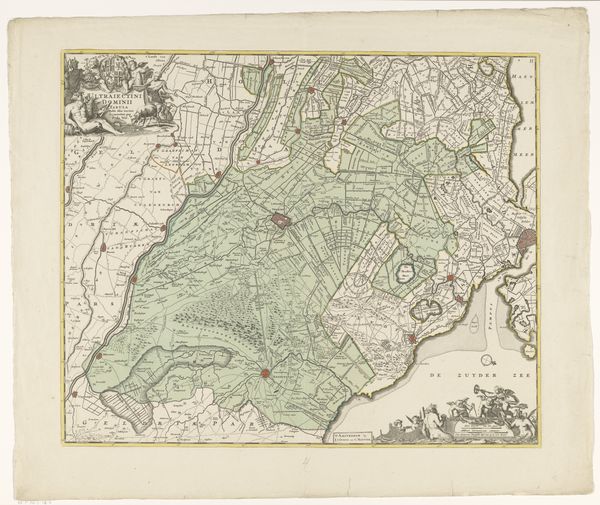
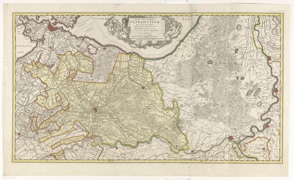
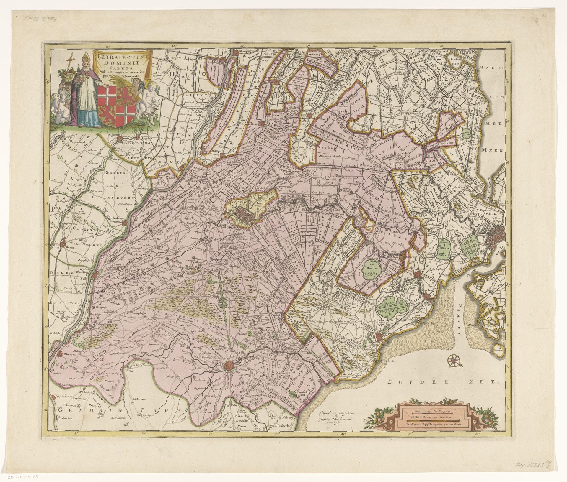
Kaart van de provincie Utrecht
Anonymous
@anonymousLocation
RijksmuseumListen to curator's interpretation
Curatorial notes
Curator: Take a look at this fascinating map, entitled "Kaart van de provincie Utrecht," created between 1684 and 1701. Editor: It strikes me as rather elegant, actually. The subdued colors and intricate lines give it a certain refined aesthetic. Curator: The piece comes to us anonymously and employs the printmaking method of engraving, fitting neatly into the Dutch Golden Age tradition. What is especially intriguing is understanding maps from this era, not merely as guides, but as commodities tied to Dutch mercantile power. Editor: True, but first, observe the compositional structure! Note the decorative elements surrounding the cartography itself, and how the use of linear perspective dictates our understanding of the physical space of Utrecht at the time. Curator: Let's consider the paper quality and the engraving process; How accessible were these materials, and what level of skill would artisans need to produce prints like this? That labor, though hidden in the final presentation, informs the print's value beyond mere aesthetics. These maps also aided trade routes. They held very tangible political and social power. Editor: Agreed! We cannot ignore how symbolic systems operate here. The carefully etched lines, color gradations, and allegorical vignettes—these weren't mere practicalities; they infused the land with coded meanings reflecting social hierarchies and even aesthetic ideals. Curator: Right. Who commissioned these prints and how were they circulated? Were they readily available, affordable art or specialized tools exclusive to privileged sectors of Dutch society, useful for administrators and landowners? These answers would shape our interpretations significantly. Editor: Precisely! As a cultural artifact, it opens avenues into 17th-century society through form and materials. Look how boundaries are articulated: the use of varied line weights to differentiate regions speaks volumes about the way space was understood, both literally and symbolically! Curator: Absolutely. It encourages us to consider who the target consumer was and the relationship this map had to emerging colonial endeavors as well as intra-European commercial ones. Its beauty lies in its practicality, but even moreso as a piece intrinsically tied to its social and historical origins. Editor: It is intriguing. It gives insight not only into geographical data of its time, but a way to reflect on how a symbolic schema can impact society itself.