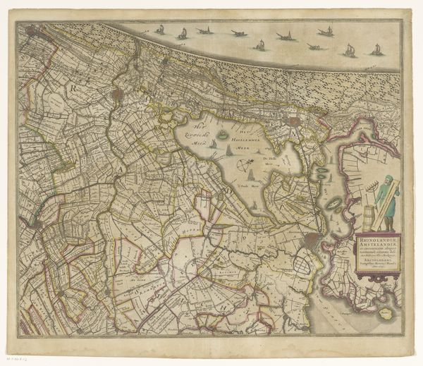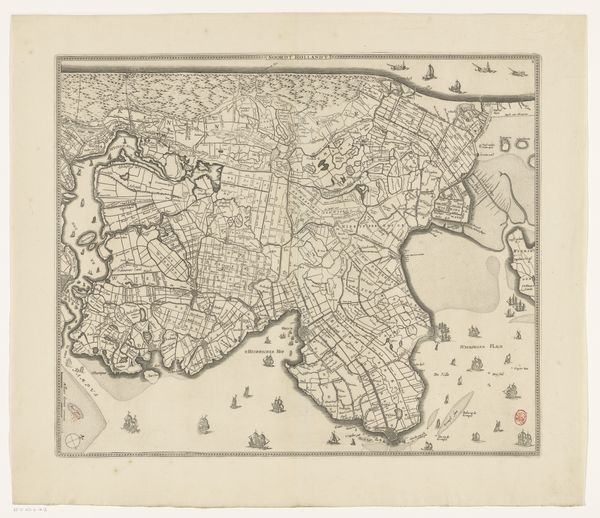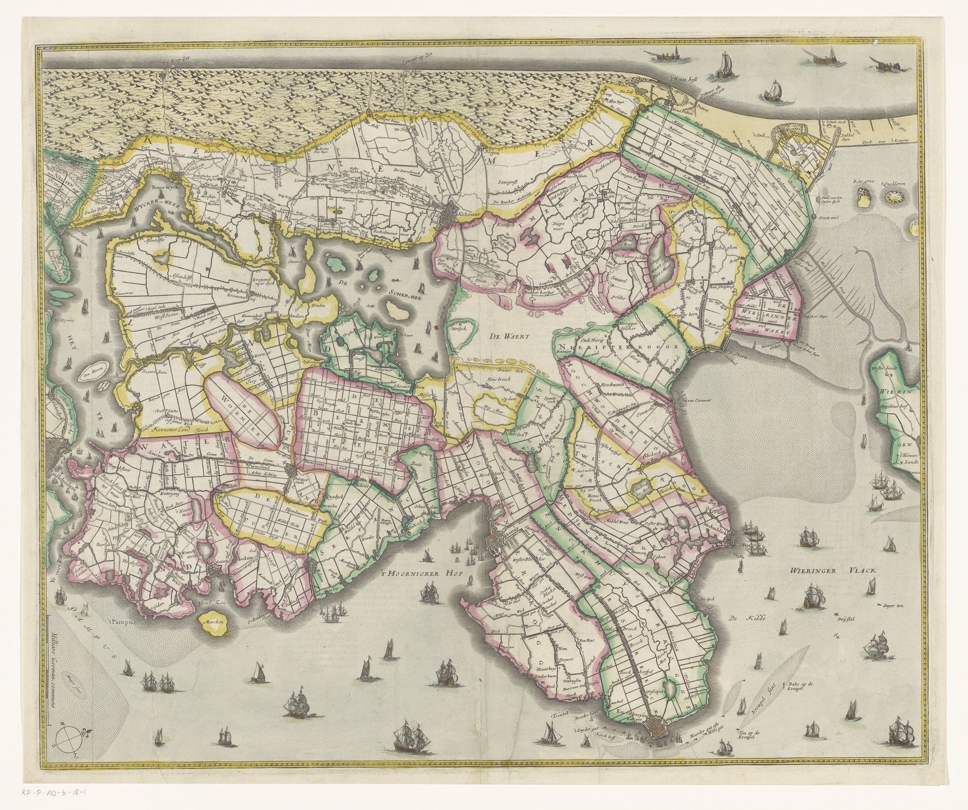
1629 - 1633
Kaart van Noord-Holland
Anonymous
@anonymousLocation
RijksmuseumListen to curator's interpretation
Curatorial notes
Curator: Alright, let’s jump in. Editor: This is an "Kaart van Noord-Holland," a map of North Holland, created between 1629 and 1633 by an anonymous artist. It's a print, an engraving, hanging here at the Rijksmuseum. It has so much detail, all these little sailing ships! What's your initial reaction to this? Curator: Beyond its functional aspect as a map, I am moved by how much it whispers of Dutch ambition and curiosity during the Golden Age. Editor: How so? Curator: Well, maps were not just geographical tools back then, were they? They were symbols of power, trade, and the expanding world as known to Europeans. Looking at the neat little parcels of land, you could almost feel the pull of land reclamation efforts that shaped this landscape. Each polder represents ambition made tangible. Tell me, what do the little boats bobbing on the sea say to you? Editor: Hmmm... Exploration, definitely. The Netherlands as a seafaring nation. It makes the landscape itself feel less… fixed. Curator: Precisely! Also, think about the implied artistry. This was crafted long before satellite imaging. This image is created through rigorous surveying, painstaking engraving. Editor: And imagine all the hands it passed through. Curator: Indeed! What strikes me now is that, in our world saturated with instant cartography, what wisdom does this print have to share about how we look at the spaces around us? Editor: I see what you mean! Now I am appreciating the blend of art and utility and that it documents a culture’s efforts to literally shape its world.