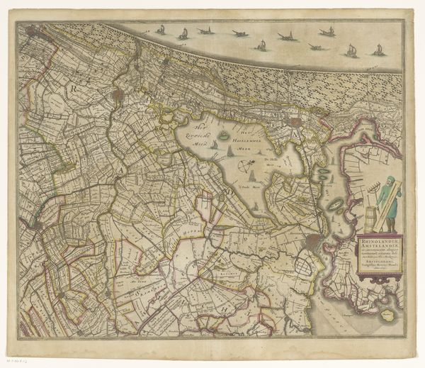
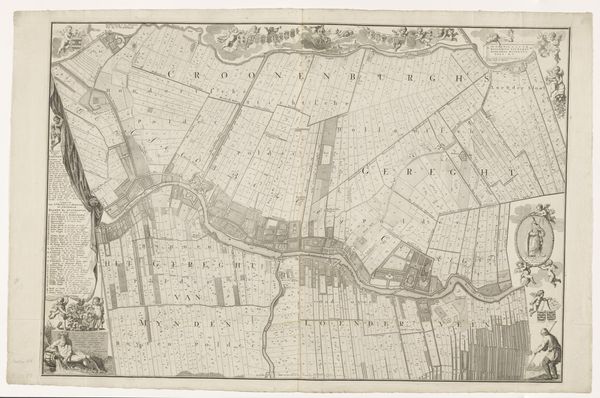
Kaart van het Hoogheemraadschap van Rijnland (zesde deel) 1647 - 1687
0:00
0:00
cornelisidanckerts
Rijksmuseum
print, engraving
#
dutch-golden-age
# print
#
pen sketch
#
old engraving style
#
landscape
#
geometric
#
engraving
Dimensions: height 457 mm, width 570 mm
Copyright: Rijks Museum: Open Domain
This map of the Rijnland region was created by Cornelis Danckerts the Elder in the 17th century using engraving. Notice the careful arrangement of lines, text, and symbols, which function not just to represent geographical space, but also to convey information about land ownership and administrative divisions. The map's composition is structured by a network of lines representing waterways, roads, and property boundaries. This grid-like structure imposes a rational order onto the landscape, reflecting the Dutch preoccupation with land management and hydraulic engineering. The strategic placement of place names and decorative elements, like ships and vegetation, serve as visual cues, guiding the viewer's eye and reinforcing the map's semiotic function. Consider how the map destabilizes traditional notions of landscape representation. It offers not a picturesque view, but a schematic overview, prioritizing utility over aesthetic pleasure. It invites us to consider how the representation of space is always an act of interpretation.
Comments
No comments
Be the first to comment and join the conversation on the ultimate creative platform.
More like this