About this artwork
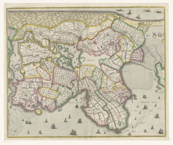
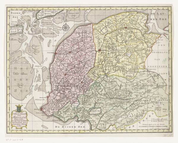
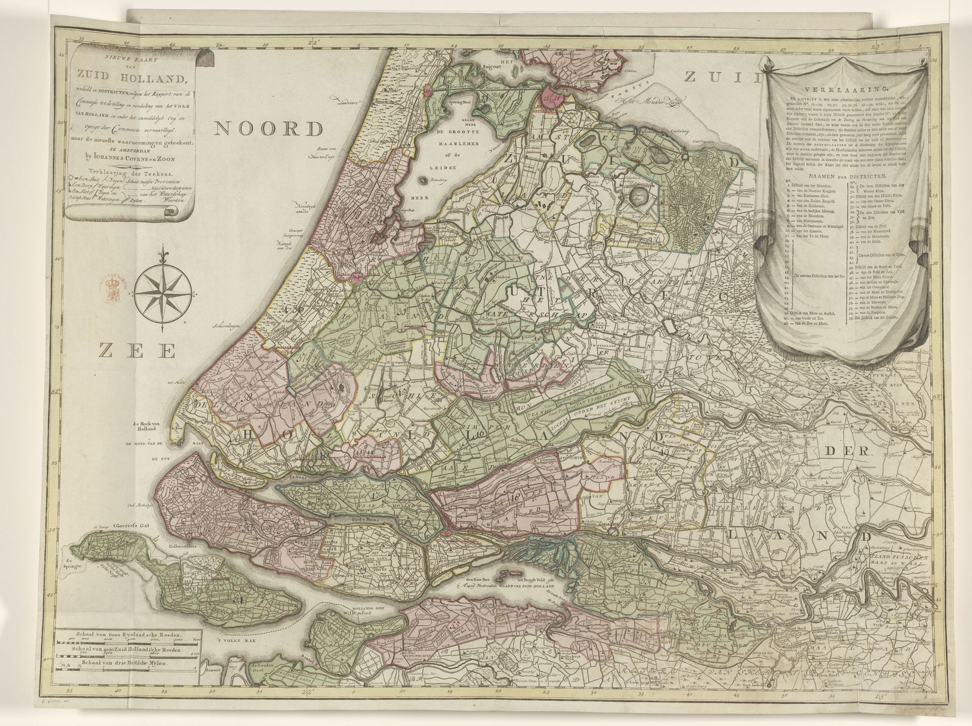
This is Cornelis van Baarsel's 1796 map of Zuid-Holland, its details meticulously rendered. Notice the pastel blocks of green and pink, dividing the land into districts, a surprisingly decorative way to visualize governance. The composition's tension comes from the contrast between organic forms and rigid geometry. The coastline's soft undulation is set against the sharp, man-made grid that dissects the land. This interplay highlights a dialogue between nature and the human imposition of order. Consider how the map functions as a semiotic system. Each line, color, and symbol is a signifier. Together, they construct a coded representation of space, power, and knowledge. By mapping the region in districts, Van Baarsel invites us to analyze how such structures categorize and control space. Note the paradoxical nature of maps in general: they are both objective tools and subjective interpretations. Through this map, we observe how spatial representation can be manipulated, intentionally or otherwise. The map is a symbol that operates on a cultural level and invites ongoing scrutiny.
Artwork details
- Medium
- graphic-art, print, etching, paper, engraving
- Dimensions
- height 609 mm, width 810 mm
- Copyright
- Rijks Museum: Open Domain
Tags
Comments
Share your thoughts
About this artwork
This is Cornelis van Baarsel's 1796 map of Zuid-Holland, its details meticulously rendered. Notice the pastel blocks of green and pink, dividing the land into districts, a surprisingly decorative way to visualize governance. The composition's tension comes from the contrast between organic forms and rigid geometry. The coastline's soft undulation is set against the sharp, man-made grid that dissects the land. This interplay highlights a dialogue between nature and the human imposition of order. Consider how the map functions as a semiotic system. Each line, color, and symbol is a signifier. Together, they construct a coded representation of space, power, and knowledge. By mapping the region in districts, Van Baarsel invites us to analyze how such structures categorize and control space. Note the paradoxical nature of maps in general: they are both objective tools and subjective interpretations. Through this map, we observe how spatial representation can be manipulated, intentionally or otherwise. The map is a symbol that operates on a cultural level and invites ongoing scrutiny.
Comments
Share your thoughts