1693
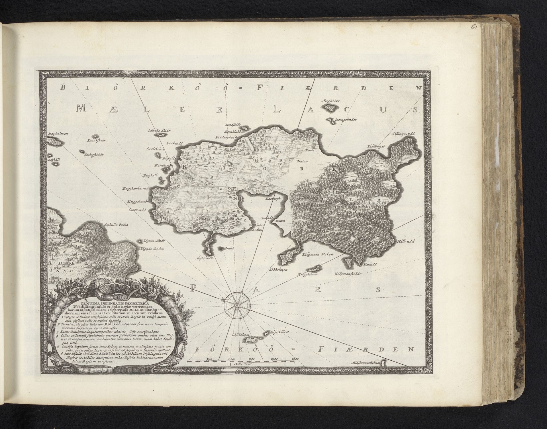
Kaart van het eiland Björkö in het Mälarmeer
Willem Swidde
1661 - 1697Location
RijksmuseumListen to curator's interpretation
Curatorial notes
Willem Swidde produced this map of Björkö Island in Lake Mälaren using etching techniques during the late 17th century, a period marked by Sweden's rise as a major power in Northern Europe. Maps of this era were not merely geographical tools; they were powerful assertions of ownership and control. Swidde's map reflects a worldview deeply rooted in the politics of expansion, illustrating the intimate relationship between knowledge, power, and the shaping of cultural identity. Consider that such detailed mapping often preceded colonial or military endeavors, making cartographers like Swidde instrumental figures in territorial conquest and administration. This map offered a perspective that prioritized imperial interests, often overshadowing the lived experiences and indigenous knowledge of the local inhabitants. This work presents an official, dominant narrative, influencing how the space was perceived and claimed by those in power. We might reflect on the layers of history embedded within this seemingly straightforward depiction, acknowledging the complex interplay between personal experience and hegemonic representation.