print, engraving
# print
#
landscape
#
cityscape
#
northern-renaissance
#
engraving
Dimensions: height 340 mm, width 467 mm
Copyright: Rijks Museum: Open Domain
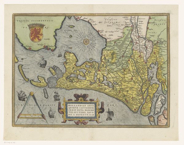
This map of Zeeland was created by Frans Hogenberg around the late 16th century, using engraving techniques. Typically, the process involves cutting lines into a metal plate, applying ink, and then pressing paper onto the plate to transfer the image. The fine lines and intricate details, from the ships at sea to the depiction of Zeeland's geography, highlight Hogenberg’s skill and labor. The texture of the paper adds depth to the print, while the use of color, applied later, brings the map to life, distinguishing territories and adding visual interest. Cartography like this was crucial for trade, navigation, and asserting territorial claims. It represents a significant investment in knowledge and craft. This map is more than just a geographical tool; it’s a carefully crafted object that reflects the economic and political landscape of its time. It reminds us that even seemingly straightforward images are deeply embedded in histories of production and power.
Comments
No comments
Be the first to comment and join the conversation on the ultimate creative platform.
More like this