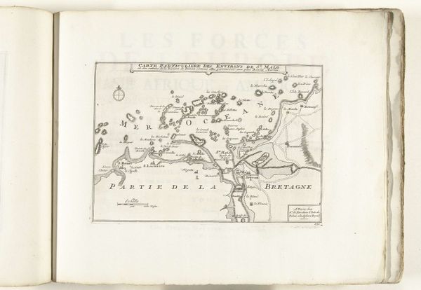
1693 - 1695
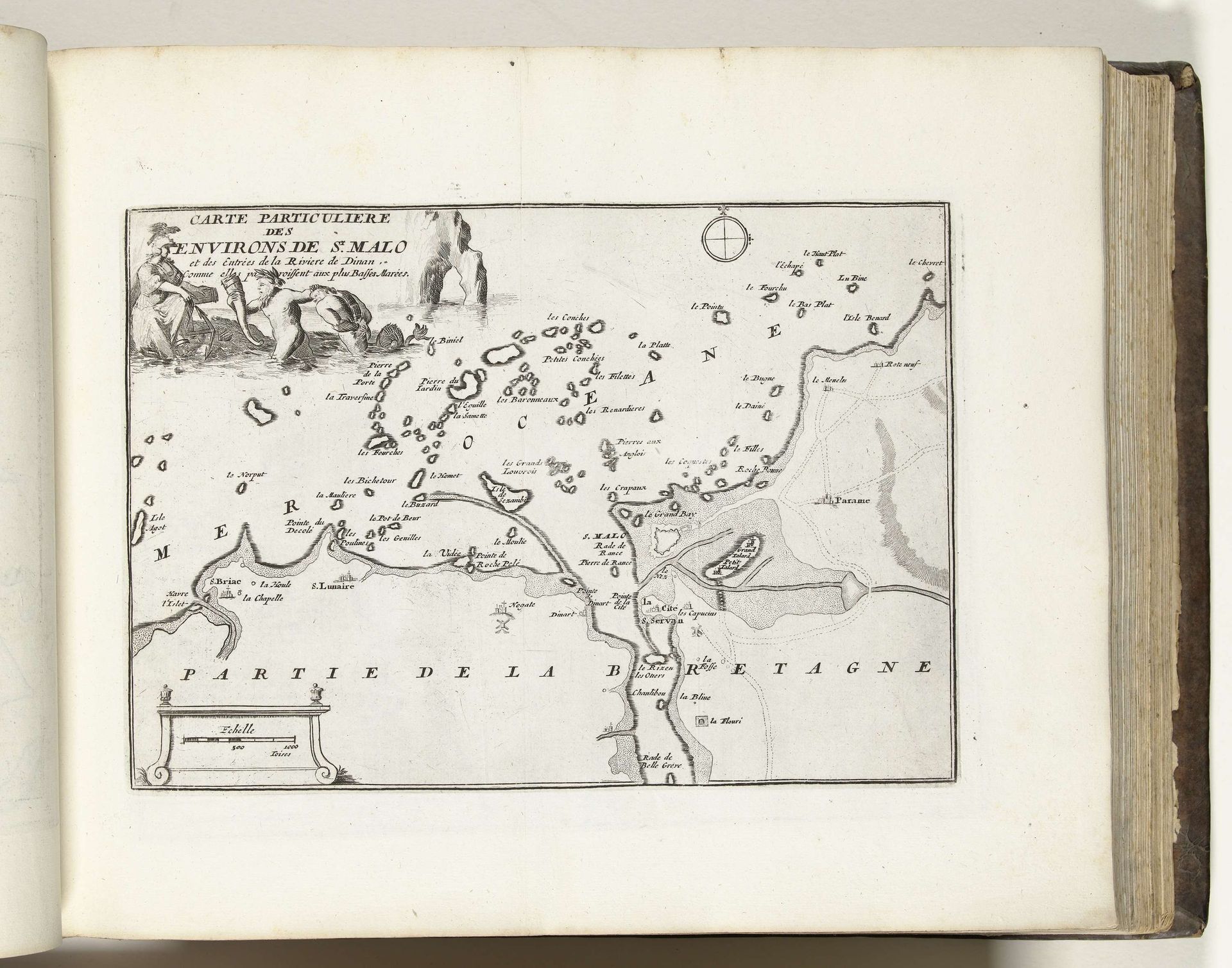
Kaart van de omgeving van Saint-Malo, ca. 1693-1695
Anonymous
@anonymousLocation
RijksmuseumListen to curator's interpretation
Curatorial notes
This is an anonymous map of the area surrounding Saint-Malo, made around 1693 to 1695. As we look at this detailed portrayal of the coast of Brittany, we are also looking at the socio-political landscape of the time. Maps have always been more than just geographical tools; they are instruments of power. Cartography in this period was deeply entwined with military strategy, economic interests, and territorial claims. Saint-Malo, a strategic port city, was of critical importance. Note the embellishments: the compass rose, the scale, and the figures in the upper left corner. These elements speak to the map's function as a tool of statecraft. The blank spaces also speak volumes. They remind us of the limits of knowledge, the areas beyond the reach of the mapmaker's gaze. Consider the stories of those who lived in these unmapped spaces, whose lives were rendered invisible by the dominant narratives of the time. How do such representations shape our understanding of history and identity?