drawing, print, engraving
#
drawing
#
aged paper
#
toned paper
#
baroque
# print
#
old engraving style
#
landscape
#
personal sketchbook
#
pen work
#
sketchbook drawing
#
cityscape
#
sketchbook art
#
engraving
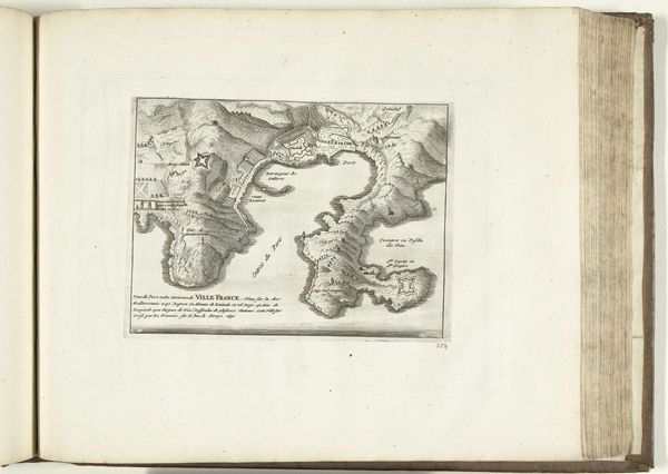
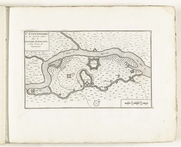
Dimensions: height 159 mm, width 215 mm
Copyright: Rijks Museum: Open Domain
This is an anonymous map of Villefranche-sur-Mer and its surroundings, created around 1702. Note the prominent star fortresses positioned strategically around the bay, symbols of military power and control. The star fort, with its origins in Renaissance Italy, evolved from simple square keeps to complex geometric designs. The multiple points, or bastions, were developed to eliminate dead zones and provide overlapping fields of fire, making them almost impregnable. Echoes of these star-shaped fortifications can be found across Europe and beyond, each iteration adapted to its unique landscape and strategic needs. Consider how this symbol of defensive might has been reinterpreted in different contexts, from medieval castles to modern urban planning. The emotional and psychological weight of such symbols taps into our primal instincts of security and territoriality, creating a deep, subconscious resonance that transcends time. As we trace its journey through the ages, the star fortress reminds us of the cyclical nature of history, where old forms resurface, evolve, and take on new meanings in response to ever-changing human needs and desires.
Comments
No comments
Be the first to comment and join the conversation on the ultimate creative platform.
More like this