graphic-art, print, etching, engraving
#
graphic-art
#
medieval
#
dutch-golden-age
# print
#
etching
#
etching
#
engraving
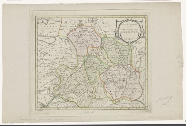
Dimensions: height 384 mm, width 528 mm
Copyright: Rijks Museum: Open Domain
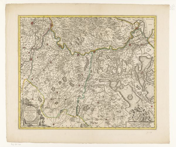
Abraham van den Broeck created this map of Drenthe sometime between 1646 and 1688, using engraving. This map reflects a time when cartography was as much about power and control as it was about geographic accuracy. Consider how maps like this one played a role in shaping the identity and understanding of regions like Drenthe. It also raises questions about who gets to define the boundaries and narratives of a place. In the 17th century, the Dutch Republic was a major player in global trade and exploration. This map of Drenthe provides a glimpse into the local context of that larger story. It suggests a need to define and control territory, both for economic and political reasons. It prompts us to reflect on the relationship between local identity and broader geopolitical forces.
Comments
No comments
Be the first to comment and join the conversation on the ultimate creative platform.
More like this