1769
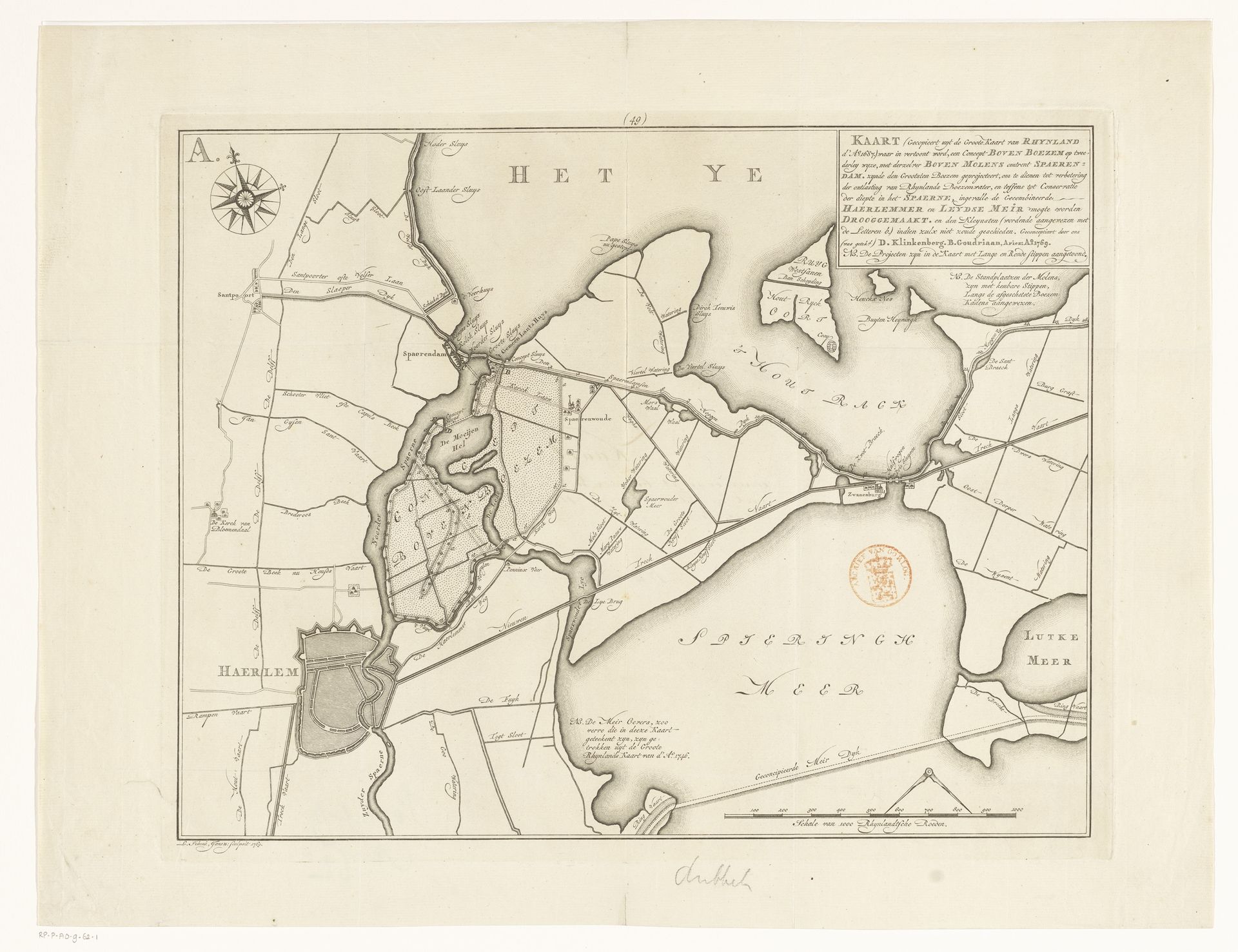
Kaart met een concept bovenboezem bij Spaarndam
Listen to curator's interpretation
Curatorial notes
Leonardus Schenk Jansz made this map depicting the area near Spaarndam, likely in the late 18th century, using pen and ink. The map gives us insights into the complex relationship the Dutch have had with water management. The careful surveying and detailed rendering of waterways, polders, and land divisions reflects the immense effort and engineering required to reclaim land and protect it from flooding. The map emphasizes human intervention in shaping the landscape, a testament to Dutch ingenuity but also a reminder of the constant need to maintain these systems. We might consider the influence of institutions like the Hoogheemraadschap, the water management boards, and the economic structures that incentivized land reclamation. It can be seen as both a practical tool and a representation of Dutch identity, one deeply intertwined with the struggle against the sea. Delving into archives and engineering reports from the period, we can better understand the social, economic, and political factors that influenced the creation and interpretation of such cartographic works.