About this artwork
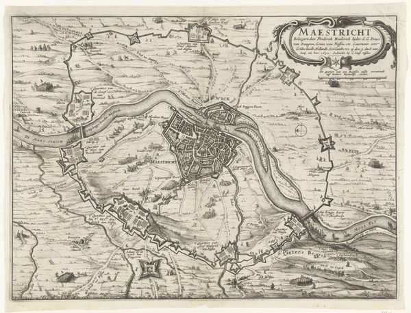
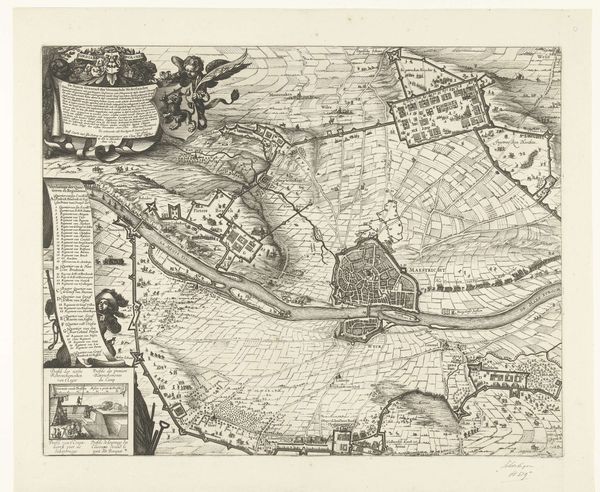
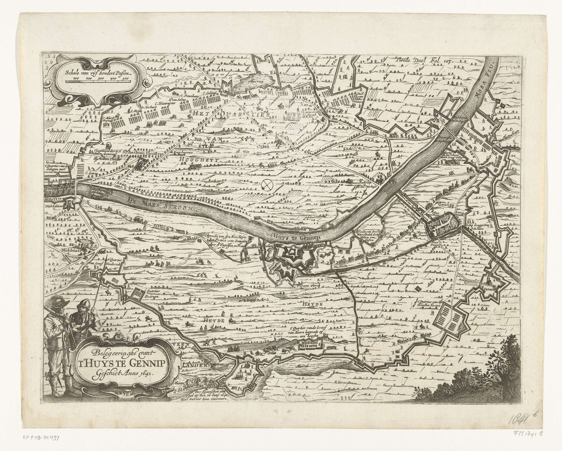
This is an anonymous map of the siege of Gennep, dating back to 1641. It's an etching, defined by dense, precise lines that illustrate a bird's-eye view of the military action. The composition is dominated by the river that snakes through the landscape, dividing the territories. We see structured fortifications and battle formations, rendered with remarkable detail. The lines create a textured surface, illustrating fields, fortifications and troop deployments. What's interesting here is the tension between objective representation and symbolic encoding. The map aspires to be a factual document of a military event, but it is also a highly constructed image. The organization of space, the strategic placement of elements, all serve a purpose beyond mere information. It reflects the period's interest in portraying not just the 'what' but the 'how' and 'why' of territorial control and military strategy. Notice how the lines create a sense of order, imposing a structure upon the landscape. This speaks to the broader cultural impulse to categorize, control, and understand the world through rational frameworks.
Artwork details
- Medium
- drawing, print, ink, engraving
- Dimensions
- height 265 mm, width 363 mm
- Location
- Rijksmuseum
- Copyright
- Rijks Museum: Open Domain
Tags
Comments
Share your thoughts
About this artwork
This is an anonymous map of the siege of Gennep, dating back to 1641. It's an etching, defined by dense, precise lines that illustrate a bird's-eye view of the military action. The composition is dominated by the river that snakes through the landscape, dividing the territories. We see structured fortifications and battle formations, rendered with remarkable detail. The lines create a textured surface, illustrating fields, fortifications and troop deployments. What's interesting here is the tension between objective representation and symbolic encoding. The map aspires to be a factual document of a military event, but it is also a highly constructed image. The organization of space, the strategic placement of elements, all serve a purpose beyond mere information. It reflects the period's interest in portraying not just the 'what' but the 'how' and 'why' of territorial control and military strategy. Notice how the lines create a sense of order, imposing a structure upon the landscape. This speaks to the broader cultural impulse to categorize, control, and understand the world through rational frameworks.
Comments
Share your thoughts