drawing, print, paper, engraving
#
drawing
#
dutch-golden-age
# print
#
landscape
#
paper
#
geometric
#
natural palette
#
engraving
Dimensions: height 400 mm, width 503 mm
Copyright: Rijks Museum: Open Domain
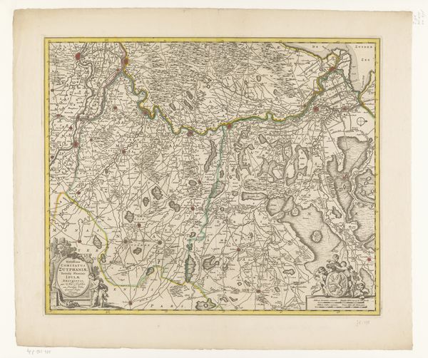
This is an anonymous map of the western part of Flanders, held at the Rijksmuseum. The map's power lies not in its accuracy but in how it organizes space through symbolic marks and careful arrangement. Note how the cartographer uses line and colour to define regions and boundaries. These aren't just geographic markers; they are semiotic tools. They establish a visual language that speaks of ownership, control, and identity. The neat lines and calculated forms suggest a world ordered and understood. Look at how place names are printed in a clear font, asserting their presence and importance. The detailed depictions of forests and cities aren't merely representational; they reinforce cultural narratives and power structures. Each element functions as a sign within a structured system, constructing a particular view of the world. Consider that this map isn't a neutral depiction of space. It's a carefully constructed image that conveys specific social and political messages. It asks us to examine not just what is shown, but how it is shown, and what that might reveal about the intentions and values of its creator.
Comments
No comments
Be the first to comment and join the conversation on the ultimate creative platform.
More like this