drawing, print, pen
#
drawing
#
baroque
# print
#
landscape
#
coloured pencil
#
pen
#
cityscape
#
watercolor
Dimensions: height 267 mm, width 372 mm
Copyright: Rijks Museum: Open Domain
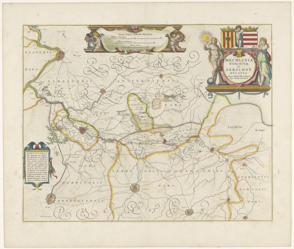
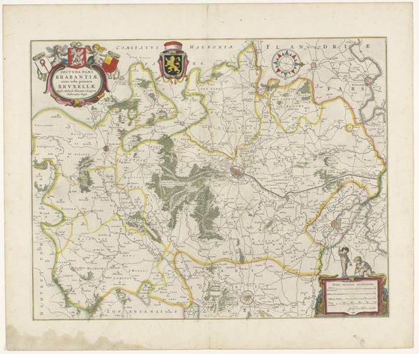
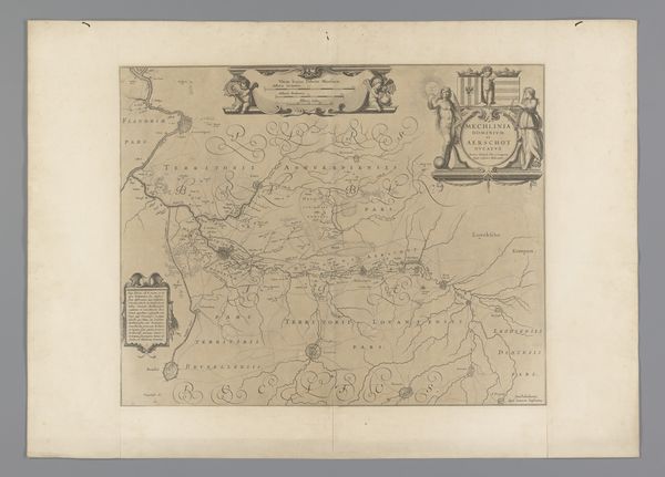
This is an anonymous rendering of "Beleg van Menen," or the Siege of Menen, from 1706. This hand-colored engraving presents a bird’s-eye view of the fortified city, its layout and surrounding areas meticulously mapped. The use of color differentiates terrains, with swathes of green fields, blue waterways, and structured browns denoting the urban and military architecture. At its core, the image is a study in structure, revealing much about the 18th-century obsession with order and control. The star-shaped fortifications are clearly defined, symbolizing a strategic attempt to impose geometric rationality onto the natural landscape. The use of perspective flattens the terrain, reducing the landscape to an abstract pattern. This cartographic flattening suggests the reduction of lived experience into data, useful for military planning. This rendering uses formal elements to articulate power. The very act of mapping transforms the territory into a readable, controllable space. This is not just a picture of a place; it's a symbolic assertion of dominance. The map invites us to consider how such visual representations participate in the broader history of territorial conquest and control.
Comments
No comments
Be the first to comment and join the conversation on the ultimate creative platform.
More like this