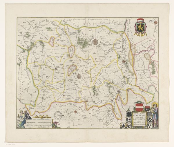
Kaart van het kwartier van Brussel, onderdeel van het hertogdom Brabant 1642 - 1664
0:00
0:00
print, etching, paper
#
dutch-golden-age
# print
#
etching
#
landscape
#
etching
#
paper
#
geometric
#
architectural drawing
#
cityscape
Dimensions: height 416 mm, width 528 mm
Copyright: Rijks Museum: Open Domain
This map of Brussels, part of the Duchy of Brabant, emerges from an era of political and cultural transformation. Created by an anonymous artist, this cartographic endeavor provides insight into the identities, claims, and ambitions of the region. The artist uses symbols, colors, and spatial relationships that not only document geographical information but also convey social hierarchies, political affiliations, and cultural values. Notice how the map meticulously outlines territorial boundaries, and depicts cities and regions, reflecting the complex interplay of power and identity in this region. What is included, and what is left out? How might this cartographic representation shape the self-perception and collective memory of those who live in this geographical space? Maps are about power, and this image offers us a chance to consider the emotional and personal relationship between identity, place, and belonging.
Comments
No comments
Be the first to comment and join the conversation on the ultimate creative platform.
More like this