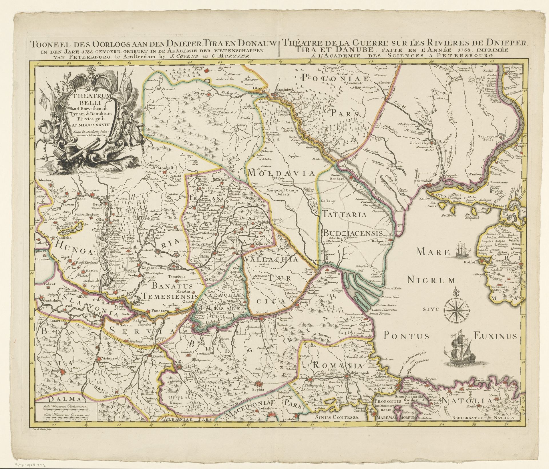
1738
Kaart van Zuidoost-Europa
Jan Punt
1711 - 1779Location
RijksmuseumListen to curator's interpretation
Curatorial notes
This map of Southeastern Europe was made by Jan Punt, probably sometime around the middle of the 18th century. It's an engraving, which means the image was incised into a metal plate, inked, and then printed onto paper. Look closely, and you’ll see how the character of the engraved line defines the image, from the fine hatching that gives tone to the land, to the crisp lettering of the place names. Each of these lines would have taken time and skill to create, and then more time to print. The map is a document of a very specific historical moment, ‘het Tooneel des Oorlogs’, or ‘theater of war’, when the Russian Empire was expanding south, fighting wars against the Ottoman Empire. Maps like this were tools of power and control, used to plan military campaigns and administer territory. The labor involved in its production reflects this history, a potent reminder of the connection between craft, conflict, and commerce.