About this artwork
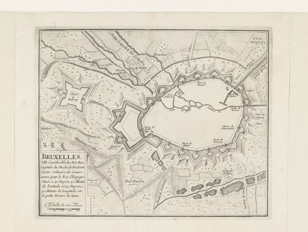
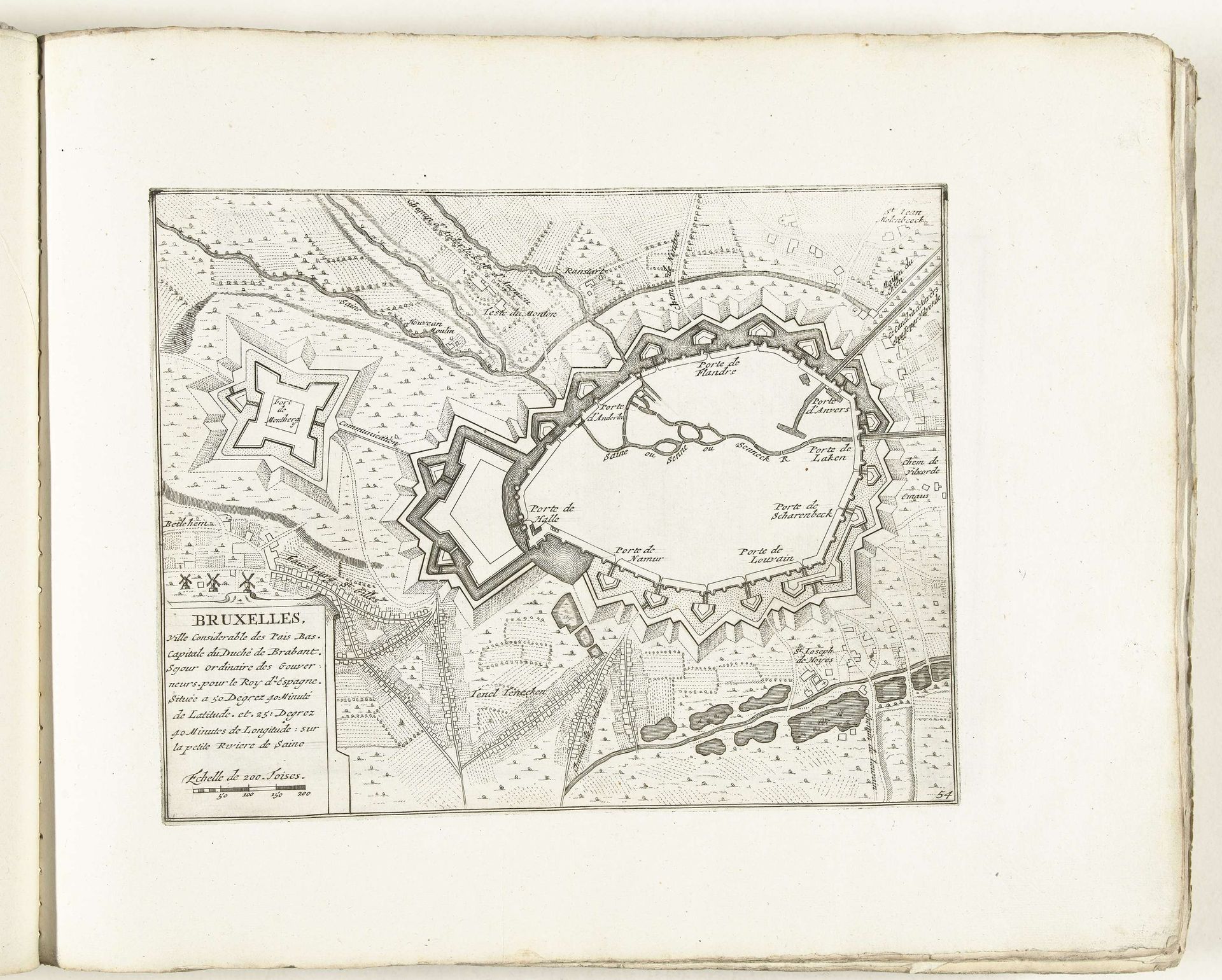
This is an anonymous map of Brussels, created around 1702. The overall visual experience is dominated by the intricate, geometric patterns of the city's fortifications. Note the stark contrast between the dense, structured lines of the urban plan and the more organic, flowing lines representing the surrounding landscape. The rigid structure of the map emphasizes control and order, reflecting the period's obsession with military strategy and urban planning. The fortifications, with their star-shaped bastions, challenge established notions of space. They destabilize the conventional boundaries between inside and outside, security and threat. The map, therefore, functions as more than a mere representation of geography. It reflects broader cultural codes, communicating power, control, and the strategic mindset of the early 18th century. The absence of color directs our attention to line and form, underscoring the intellectual framework through which the city was conceived and controlled. It’s a diagram of power as much as a geographical document.
Artwork details
- Medium
- drawing, print, ink, engraving
- Dimensions
- height 222 mm, width 283 mm
- Location
- Rijksmuseum
- Copyright
- Rijks Museum: Open Domain
Tags
Comments
Share your thoughts
About this artwork
This is an anonymous map of Brussels, created around 1702. The overall visual experience is dominated by the intricate, geometric patterns of the city's fortifications. Note the stark contrast between the dense, structured lines of the urban plan and the more organic, flowing lines representing the surrounding landscape. The rigid structure of the map emphasizes control and order, reflecting the period's obsession with military strategy and urban planning. The fortifications, with their star-shaped bastions, challenge established notions of space. They destabilize the conventional boundaries between inside and outside, security and threat. The map, therefore, functions as more than a mere representation of geography. It reflects broader cultural codes, communicating power, control, and the strategic mindset of the early 18th century. The absence of color directs our attention to line and form, underscoring the intellectual framework through which the city was conceived and controlled. It’s a diagram of power as much as a geographical document.
Comments
Share your thoughts